Check the weather, check the tide, check the swell!
Great rock climbing exists on seacliffs near Charleston, on the West Coast between Greymouth and Westport. The cliffs are up to 40 metres high and consist of gneiss, a metamorphised granite. The quality is generally good. A great variety of climbing is found: delicate face climbs, crack climbs, chimneys, corners and overhangs. The holds are usually large and the harder climbs are steep. Friction is excellent. Most are easy to middle grade, with only few hard routes. Many fantastic lines await ascents. Most climbs are walk on and walk off.
The West Coast has a reputation for rain, but often it is enjoying a glorious fine spell when it’s raining in Canterbury. Climbing is very pleasant throughout the year.
Routes are described from north to south, and left to right facing the cliffs. Access is walk-on, with wave-cut platforms at the base of the cliffs. Be wary of waves breaking over the platform, and keep clear of surge holes. Cover up against sandflies.
Climbing Notes
Generally the rock is sound – often perfect – but care needs to be taken with occasional loose blocks and flakes, particularly on first ascents. Bring a good rack with CDs, hexes, wedges, and so on. Climb it as you see it.
We apologise to any first ascentionists not credited. There is a strong local convention of on-sight leading of new routes: “These cliffs suit the adventurous, and not so much the tricksters.” So let's try for that ideal, and report first ascent methods precisely. Some new routes will need bolts though, and these should be placed in the best positions from a top rope. Bolts, hangers and inserts must be of stainless steel only, because of the high corrosion rate.
History
Early use was made of the cliffs by Buller High School under the watchful eye of Paul Caffyn. Since then, more than 170 routes have been led. Key figures in the development of the cliffs include Paul Wopereis, Ronan Grew, and Rick Harding. Visitors such as Louise Shepherd and Dave Fearnley have added some hard lines.
More recently Nick Cradock and friends have been adding more modern routes into the area.
Charleston used to be a goldrush boomtown. In 1868 several thousand diggers were in residence, serviced by 60 hotels. It’s a little quieter now.
Accommodation
Please be responsible and clean campers and use the campground or motel. Camping at Constant Bay is no longer permitted.
Charleston is 28km south of Westport and 77km north of Greymouth on State Highway 6. From downtown Charleston, turn towards the coast heading for Constant Bay Recreation Reserve.
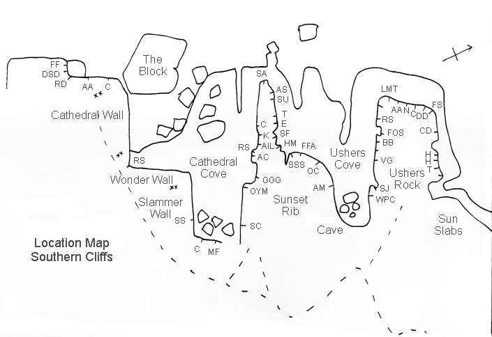
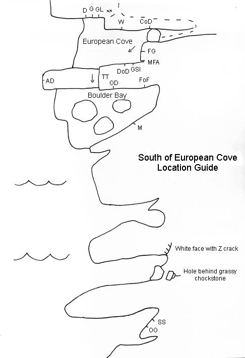
The popular southern areas, from Usher’s Rock to Boulder Bay, are approached from the Constant Bay carpark by walking south on a well-formed track for 10 minutes.
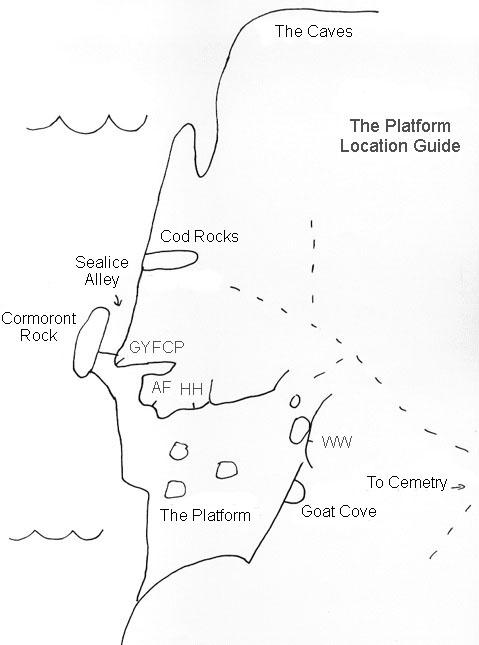
The northern rocks may be approached from the cemetery via a rough track which leads to Cod Rocks and The Platform. Another track branching left off this after 200m leads to the popular Bolt City Boulders, and, by scrambling south along the coast, The Prow and Goat Cove.
To find Tunnel Cove and Robertson's Cove, scramble around the rocks from the north of Joyce’s Bay and find a fisherman’s track leading to Point Robertson. Branching off this track up a gully to the right is a rough track leading to Tunnel Cove (and also Goat Cove). From there you can scramble south to reach Robertson's Cove.


