Map
From where the 4WD route peters out near Separation Stream, the walk up valley to Separation Col is enjoyable but a little deceptive. It’s an 1100m climb from the Godley valley (route 8K on photo topo).
Boulder hop up until below the steep terminal face of the glacier. Head up a rocky gut on the true right, beneath the glacier and the moraine wall, for about 200m, then cross to the middle of the glacier. Ascend on the moraine-covered ice until below the icefall, then use a ledge system through bluffs on the true left to access the upper glacier. If the ledge system is cut off, a route may work from the Butcher valley around the western slopes of Mt Coates.
Most parties bivvy or tent near to the col or slightly toward Mt Coates.
The upper basins including the Ballium Snowfield have good ski touring options.
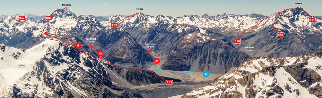
Looking east to D'Archiac and the Sibbald Range, December 2016
Canterbury Westland Alps 2009 (Yvonne Cook and Geoff Spearpoint)