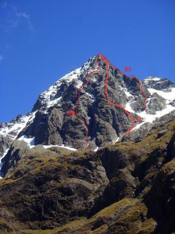
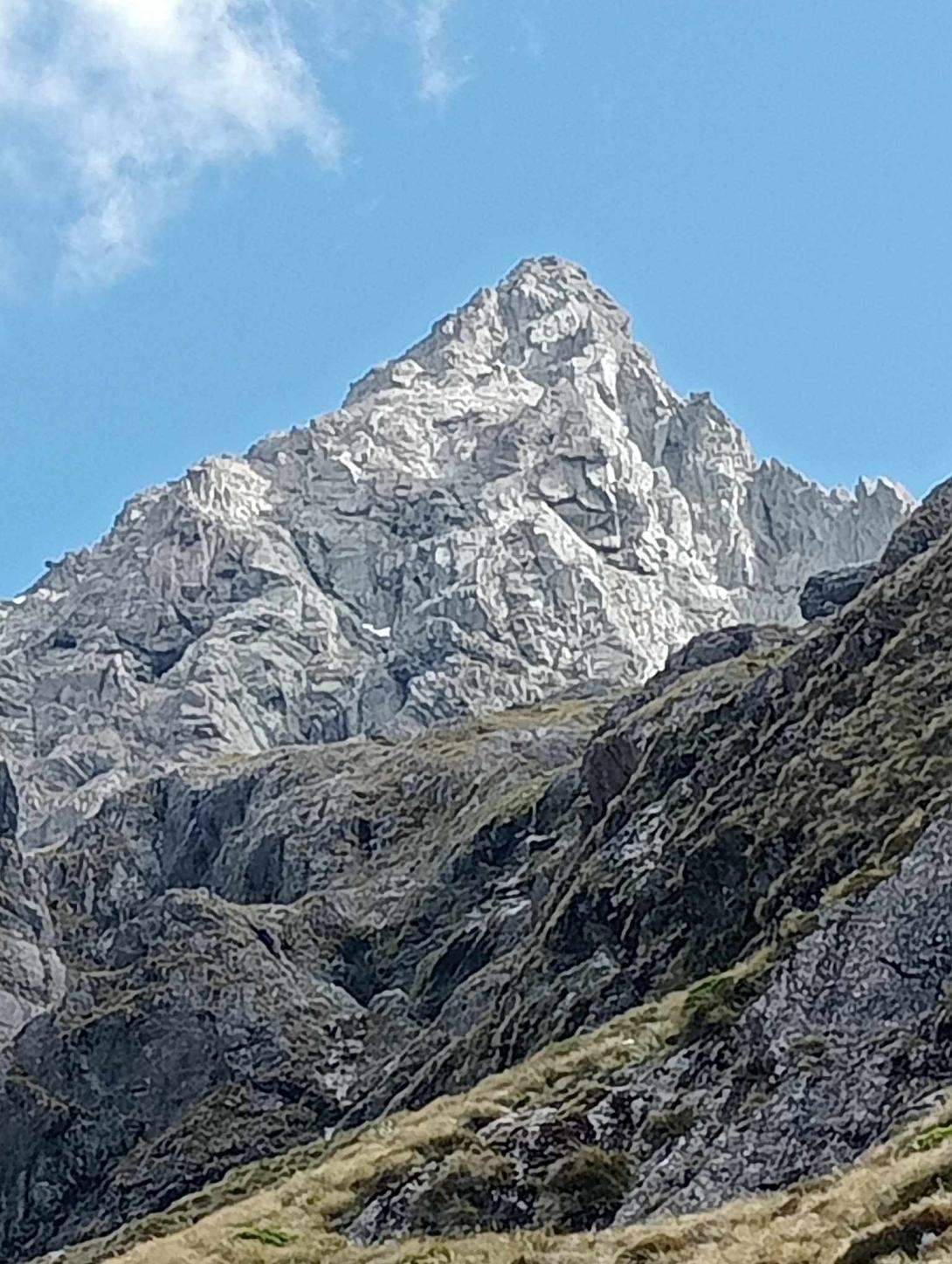
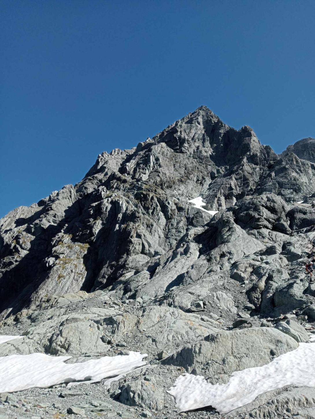
North East face of Somnus containing multiple buttresses and ridgelines leading to the large lower angled summit dome.
Access easiest from the Rock Burn via Theatre Flat. Many options exist from here.
Reasonable access has been made going up the side stream with marked 85m waterfall until where the waterfall is visible and the stream starts to enter a gorge. Here, plunge uphill to the true right into a thick bush edge which soon relents to mature beech trees on the spur, then follow good travel via more open forest and animal tracks to gain the basin NE of Pt 1800 (and upper reaches of the stream with marked 40m waterfall).
From here follow the stream upwards to gain the higher basin (1400-1500m elevation) below the NE face. A waterfall at 1360m is bypassed easily on scree slopes to the true right. Travel from this basin to the N side couloir is made via slabs, snow and gullies close under Pt 1800. Campsites are scarce 1300-1650m, but abundant on bedrock ledges higher.
Routes
| Reference | Title | Grade | Length | Pro | Quality | Alert | Operations |
|---|---|---|---|---|---|---|---|
| BD | BDNorth East Buttress, 15,4 | 15,4 | 700m | ||||
|
On Place reference photo as "BD" (Ben Dare)
The route follows the left hand of two prominent ribs that form the buttress before tending right up easier ground to finish directly on the summit. 700m of climbing mainly on solid rock with sections at up to grade 15/16, mainly on the lower buttress, before the angle eases towards the top. |
|||||||
| ST | STSomnthing, 16,4 | 16,4 | 700m | ||||
|
"We have to do "something" before I leave" - Penzy
The route follows the (lookers) rightmost large buttress on the face. Accessed by traversing in from the right up glacier carved slabs until a vegetated gravel ledge system leads to the base of the main climbing. Direct probably goes too, though in a stepwise vegetated fashion. Follow your nose through the buttress with steps of 15-16, until a face with multiple crack/corner systems with roofs on the right is reached. Pick the best looking line through the face and continue up. A section of 17 was found on the RHS of a pillar above this - you might find somnthing else! The whole route contains many options in most places. Surprisingly good rock quality! Some excellent climbing to be had. Large ledges for belays within 60m rope lengths. A rack of 5 cams 0.2-1 was carried and all used, however the gear tended on the smaller side. Large slings very useful for belays. Some significant runouts not only due to the small rack, so best to be very solid at, or better - above the grade. Descent via couloir on the N with one 30m rappel. A great day out. Access via Rock Burn and streambed/spurs beneath Pt 1943 and traversing into the basin at 1200m contour, although descent through OK bush bashing was made down the spur under Pt 1800 and into side stream with marked 85m waterfall, see Place (North East Face, Somnus) description. Route marked in Place reference photo as ST. |
|||||||
| BS | BSBattle of the Somne, 5+,19 | 5+,19 | 400m | ||||
|
High quality alpine rock climbing with a stonking 60m corner pitch to finish the technical climbing. This route climbs the furthest right buttress that can be seen from the basin below the NE face, easily identified by the striking sawtooth ridge section in the lower third. New snow and ice on the route despite it being late January made for a fair bit of battling indeed. The first attempt was aborted due to thick snow flurries and more ice than desirable on the route. However after a council of war that evening at a cold campsite, a fresh assault in the morning proved successful despite frozen rock shoes and a good honest dose of suffering - memories of which were well erased by the value of the climbing and the quality of the rock! "That was the best winter trip I've had all summer!" Descent via N ridge and snow couloir. Accessed from Rock Burn, exited via basins to the SE of Somnus and creek NE of Momus (skirmishes with scrub, slab and rapids in the canyon : take-no-prisoners terrain during proper rain) to rejoin Rock Burn track.
The route starts at the large triangular face below the sawtooth ridge. Scramble or pitch up the first buttress to meet a ledge, which can be very easily traversed climbers left to reach the start of multiple corner systems. Ascent was made via the large corner on the climbers right (see photo topo), then traversing left two corners across due to ice and lack of gear, estimated grade 19 (note cold and sad, gräy, wintery conditions made estimating grade difficult - dissension in the ranks!) Multiple options may exist via the other corners, or more easily the crest to the right. On pitch 2 (60m), a small roof to the climbers R led to a long open corner pitch to belay near the start of the sawtoothed ridge. A couple of pinnacles were able to be bypassed, some were up-and-over jobs. A good piece of alpine faffery dispatched with simul climbing and one abseil. As the sawtooth eases, the route trends left on easy rubbley rock to a ledge below a clean right-facing corner. This full 60m, highly memorable pitch at approx grade 17 (heading climbers L at the very top of the corner) leads you to easier ground. Pause to admire the commanding views of Amphion, Minos, Nox and the gorgeous Rock Burn out to Park Pass before following your nose up lower angled ground to the summit. A single rack from 00 to #2 was used with doubles in #1, 0.5-0.2, a half set of nuts, two large slings for belays, and a (mostly) positive attitude. Approx 270m of roped climbing, plus scrambling to the base of the first corner and after the top corner. |
|||||||


