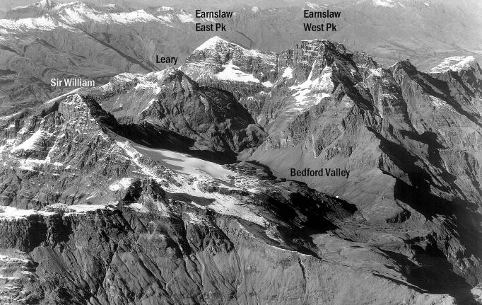
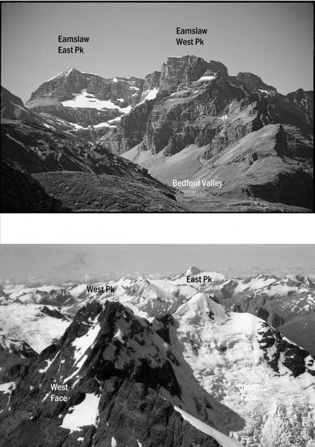
No mountain view could be more majestic and tantalising than that of the Earnslaw massif on a clear day, as one rounds the Bennett’s Bluff on the Queenstown to Glenorchy Road. The Earnslaw massif features the twin peaks of Mount Earnslaw, the second and third highest peaks of Otago. Mt Earnslaw consists of two major peaks, the East Peak and the West Peak. The massif can be approached from either the Rees Valley via Kea Basin, or from the Dart, via the Bedford Valley.
The East Peak was first climbed by guide Harry Birley alone on 16 March 1890. The first traverse from the East Peak to the West Peak was by Scott Gilkison and A. Jackson on the 11th January 1933.
Routes
| Reference | Title | Grade | Length | Pro | Quality | Alert | Operations |
|---|---|---|---|---|---|---|---|
| North Face, I,1+ | I,1+ | 0m | |||||
|
Scramble up through lower bluffs and slightly right up through scree slopes until ledges sloping steeply up to the left or a gully straight above give access through the main bluffs to the final easy slopes. Many variations are possible on the bluffs.
|
|||||||
| East Face, I,2 | I,2 | 0m | |||||
|
Traverse on to the southern section of the Birley Glacier from Wright Col and then ascend directly to the north-east ridge. The route of the first ascent, but sees few ascents nowadays.
|
|||||||
| South East Ridge, II,2 | II,2 | 0m | |||||
|
From Wright Col traverse round the Birley Glacier and snowfields to the south-east ridge. Alternatively, from the bivvy at E40 488 108 on the ridge to Esquilant Bivvy, gain the snowfields on the glacier under the East Peak and drop down to the col north of Black Peak. An alternative route is to gain the South East Ridge higher up above a prominent rocky buttress sticking out of the glacier. From Lennox Pass or the route from the Kea Basin track to Lennox Pass, gain ledges under and east of Peak 2026 at 1650m, then sidle right to the ridge leading to Black Peak. Traverse Black Peak and descend to the col. Traverse snow slopes on eastern side of ridge crest until regaining ridge. The route over Black Peak requires caution because of very loose rock. Alternatively, sidle round on the snowfields on the south side of Black Peak to gain the col and the south-east ridge.
|
|||||||
| Traverse from West Peak, II,2 | II,2 | 0m | |||||
|
From West Peak, travel either on snow or rock along the ridge joining the peaks, passing the gendarme on the north face. An alternative is to use the steep rotten gully leading to the col between the peaks (see Leader Route), which is accessible from the scree slopes leading round from Wright Col.
|
|||||||
| South Face, II,2 | II,2 | 0m | |||||
|
From Wright Col traverse round the glacier and snowfields to gain the South Face.
|
|||||||

