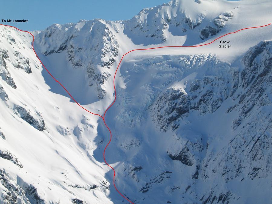
The Crow valley offers southern approaches to Mt Rolleston, and several difficult routes on to peaks of the Jellicoe Range.
Crow River via Klondyke Corner
Access to Crow Hut is available from Klondyke Corner in the Waimakariri valley by picking up a trail in the huge tussock flat on the true left of the Waimakariri prior to the Crow River junction. Once the Crow alluvial fan is reached, stay on the true left, crossing to the true right after about 600m, following a marked and cairned route for a further 4.5km (beware of rockfall and slides off the eastern flank of Mt Stewart).
Crow River via Avalanche Peak
Take either the Avalanche Peak Track (behind the Helicopter Pad) or Scott’s Track (leaves Highway 73 opposite Devil’s Punchbowl Creek). The Avalanche Peak Track climbs steeply to the bushline, whereas Scott’s Track provides a somewhat less steep route. Both tracks meet prominent ridges at the bushline. Follow the snow-pole track marking to the summit of Avalanche Peak. In winter do not attempt to cross the snow basins above Avalanche Creek or Rough Creek as risk of avalanche is very high. Time to the peak in summer is about 3 hours. From Avalanche Peak descend to the saddle between Avalanche Peak and the lower peak to the west which continues the Avalanche Peak summit ridge, dropping off the ridge to the north where necessary (scree gully). Sidle the ridge leading towards the Low Peak of Mt Rolleston. A point is reached where this ridge begins to rise noticeably more steeply (the third saddle) towards Mt Rolleston. Here a long, open scree descends to the Crow River. The correct descent scree is visibly continuous to the Crow River! As a further check, the full drop of Devil’s Punchbowl Falls is visible from the correct position on the ridge (stakes may also mark the saddle). In winter this route is prone to slide avalanche. On reaching the Crow River, Crow Hut is a 20 minute rock-hop downstream, situated on a grassy rise on the true right embankment.
