tba
Map
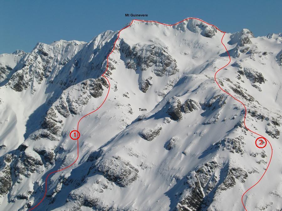
Routes
| Reference | Title | Grade | Length | Pro | Quality | Alert | Operations |
|---|---|---|---|---|---|---|---|
| Via side creek which drains from Jellicoe Ridge, 1 | 1 | 0m | |||||
may be reached either by the stream which drains from Jellicoe Ridge 1km downstream of the White River, or by scrub covered slopes opposite |
|||||||
| 2 | 2Crow Hut Route, 1 | 1 | 0m | ||||
Not easily accessible from the Crow Valley, but a route may be followed up the bluffs behind the Crow Hut using the interlocking slabs and screes (steer well clear of the waterfall gullies, Never found yourself in a situation of no return??) to the basins below the peak. Before attempting this route survey it from the summit of Lyell Peak (Grade. 2 for sheer determination) |
|||||||
| 1 | 1North East Ridge, 2 | 2 | 0m | ||||
Bash through scrub 500m south of Crow Hut, to an interesting scree gully at about 1200m elevation. A series of slabs and gullies leads to grassed slopes overlooking a tarn. Gain the North East Ridge at this point and ascend to the summit. |
|||||||