Mt Haidinger

Type
Altitude
3070m
Part of
Image
Lat/lon
-43.5513666,170.1996679, NZ Topo Map
Topo50
BX16 738 741
Add Place Add Route

Places

Type Name Alert
Face West Face
Face East Face
Face West Face

Routes

Reference Title Grade Length Pro Quality Alert Operations
 East Face Route, 3 3 0m
0

  • P1
  • Alpine (Mt Cook) 3

Climb the ridge immediately north of the Haast Glacier, overcoming a final large bump to reach the Upper Haast Glacier. From here the route heads up the snowface onto the South Ridge. Other more difficult routes may exist to the right on the upper face.


 East Spur, 3+ 3+ 0m
0

  • P1
  • Alpine (Mt Cook) 3+

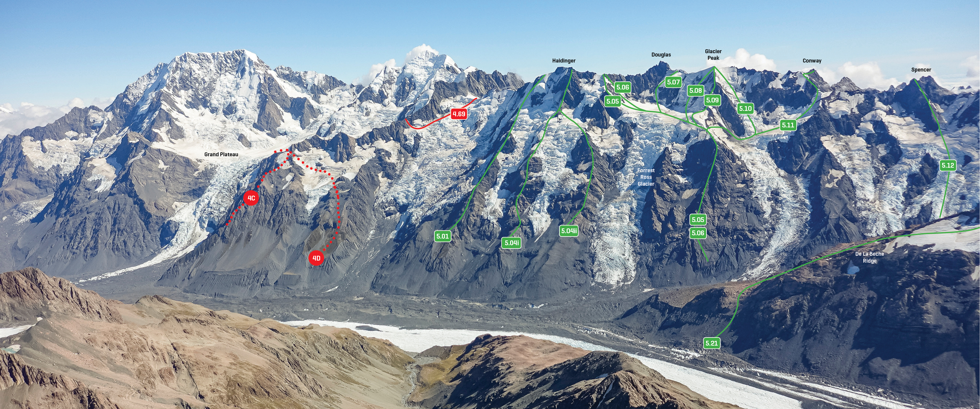
This consists of a 400m buttress of relatively loose rock, dropping from the North Peak. The spur has been gained by two routes. i) Via a rock and scree rib separating the two arms of the Kaufmann Glacier. ii) Up scree and rock south of the Forrest-Ross Glacier to a small snow basin.


 East Ridge/North East Face, 3 3 0m
0

  • P1
  • Alpine (Mt Cook) 3

These short 350m routes are gained by climbing scree slopes and a rotten ridge onto Emas Dome, then dropping to Forrest-Ross Glacier névé. Cross the névé to gain either the ridge or the face that meets the Main Divide, some distance north of the North Peak.


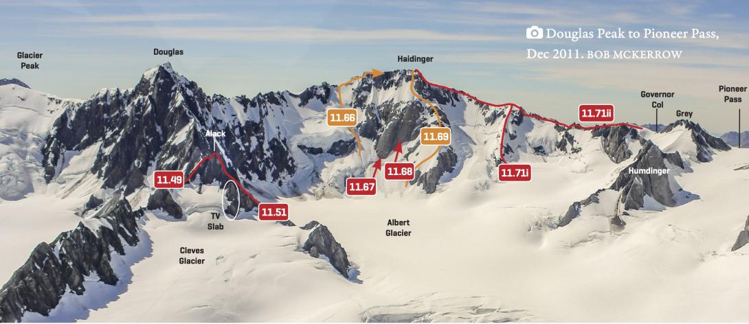
11.66 11.66Pahiatua (Haidinger-Douglas Col), II,3,3 II,3,3 0m
0

  • P1
  • Alpine (Commitment) II
  • Alpine (Technical) 3
  • Alpine (Mt Cook) 3

From the Albert Névé ascend the snow slopes left of the West Face routes.


11.70 11.70Albino Merino, II,4,4 II,4,4 0m
0

The couloir between the West and South Ridges.


  • P1
  • Alpine (Commitment) II
  • Alpine (Technical) 4
  • Alpine (Mt Cook) 4

 PLEASE DELTE see 11.71 South Ridge, Variant 0m
0

  • P1

The most elegant way lies up the arête which reaches the ridge 400m before the summit.


Comments
Attribution
Rob Frost
UUID
 
12e3e73c-aa62-4bab-911c-31ccaf395b2f