Pakihaukea Pass is the snow saddle between Whaitiri and Makere. The pass was originally used as an access from the Tūtoko valley to the Lake Turner region for the purpose of climbing Patuki. It is quite a slog in that direction, and has come to be used more often as a relatively direct descent route out of the Lake Turner basin.
Confidence in navigating very steep bush-covered terrain is needed.
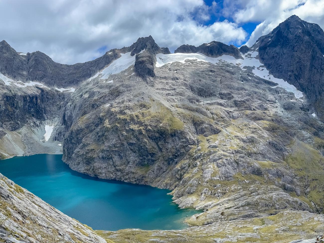
Pakihaukea Pass is at top left above the Tūtoko valley. Descend diagonally right to gain the broad shelf at the bottom of the photo.
Lake Turner to Tūtoko valley
Pakihaukea Pass is straightforward from Lake Turner.
Descend due west into the Tūtoko valley to about the 1200m contour where a broad, gently angled shelf runs north above spectacular precipices. Steep bluffs mean attempts to descend to the shelf further north from the pass will be unpleasant.
Follow this shelf northward using watercourses where possible and at about CB08 0363 4467 head up through the forest behind a shallow knob.
Now descend increasingly steeply to the north-west above a narrow gorge and waterfalls. At about the point it starts to seem a bit too steep, quite close above the waterfall, start traversing to the true left and down through scrubby forest and moss slabs to a large pool at the base of the main waterfall at about CB08 0313 4525. From here it’s best to cross the stream to continue the descent, but it's possible to reach the Tūtoko valley floor staying on the true left, if the stream is too high to cross.
Ford the Tūtoko River and pick up the track down valley.
A solid day from Lake Turner.
Images