Type
Altitude
2158m
Part of
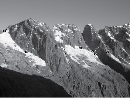
Usually traversed to travel between Turnerʻs Biv and Lake Turner. Incorrectly marked on topomaps as Mt Mahere.
Map
Accessed from
Image
Routes
| Reference | Title | Grade | Length | Pro | Quality | Alert | Operations |
|---|---|---|---|---|---|---|---|
| North Ridge | 0m | ||||||
Scramble up to the base of the North Ridge, where an initial short steep section is followed by easy scrambling to the summit. |
|||||||
| South Ridge | 0m | ||||||
A short climb from Pikipari Pass. |
|||||||
Places
| Type | Name | Alert |
|---|---|---|
| Face | East Face |
Comments
Attribution
Craig Jefferies
UUID
31962f9a-07c1-42e8-b8b9-0b552dade88d