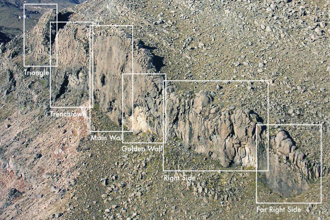
A mountain crag on generally immaculate rock only 15 minutes from the carpark. It sounds too good to be true, but some of the routes are among the best in the North Island.
The crag forms the long reverse side of the lava dike of Mead’s Wall. It faces east, high above the gulch of the Whakapapa River and beneath Ngā Tohu Pinnacle Ridge, with views towards Ngāuruhoe.
The first climbs used natural protection – the lines may not be obvious so if in doubt follow the protection. Take a full rack and a selection of slings. Double ropes may be helpful. Later development has tended to used bolts.
From the Top o’ the Bruce, walk east towards Mead’s Wall and then turn north up Te Herenga Ridge a short distance before sidling down on a rough track across the eastern slope. The track peters out at the top of the crag; continue northwards above the cliffs down to the end of the bluff line and then back up under the crag.
Descent off routes is either by abseil or by walking back around the north end of the cliff to the bottom.
