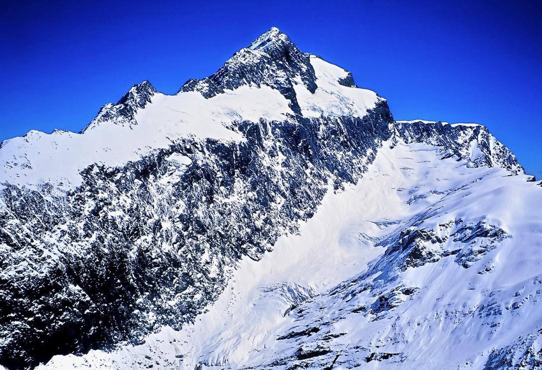
Mt Hooker is a superb massif flanked on three sides by extensive glaciers. An impressively steep north face dominates the view from the upper Ōtoko River. The first ascent by Samuel and Cyril Turner is shrouded in mystery, as Samuel Turner died before he was able to record the details of the ascent. However, the secretary of the Alpine Club at the time was satisfied that they had indeed climbed the peak, after corroboration from deer cullers working in the area. It is likely they climbed it from Marks Flat. Hooker is readily visible from the Haast and West Coast highways, and provides a powerful attraction for climbers who want to experience climbing west of the Main Divide.
From the west, a rapid approach can be made up the Ōtoko River to reach the junction with Jack Creek or, further on, the Upper Ōtoko Pass. Access can also be gained from the east by crossing the Landsborough River and Solution Range or from the south by traveling up the Landsborough and Clarke valleys.
Routes
| Reference | Title | Grade | Length | Pro | Quality | Alert | Operations |
|---|---|---|---|---|---|---|---|
| North West Ridge, II,2 | II,2 | 0m | |||||
|
Climb the spur between Marks Flat and Murdock Creek to gain the extensive Hooker Glacier. Sidle the western summit on the Ōtoko side at about 2450m, across snowfields to an arête leading to the higher eastern peak. The ridge from the low to high peak has also been traversed on the ridge crest by Bruce Jenkinson and company in the 1960s but is significantly more difficult (III, 3+).
|
|||||||
| South Ridge, III,3+ | III,3+ | 0m | |||||
|
A route leads from the Hooker Glacier directly to the high peak. Begin the climb on the western side of the ridge to get some easy height before gaining the ridge. Follow mixed ground up the ridge to reach loose schist and move carefully to the summit snowfield.
|
|||||||
| South East Ridge, V,4 | V,4 | 0m | |||||
|
Several parties attempted to climb the mountain from Lower Ōtoko Pass before it was completed in 1962. Note that early accounts describe this as the North East Ridge. A broad shelf leads across the east face until crevasses force the route up onto the summit pyramid. A large gendarme at about 2500m, which deterred several parties, is turned on the Marks Flat side to reach the east peak. A difficult, pinnacled ridge leading to the summit requires down climbing on tension at a couple of points to reach the final sharp cheval ridge. Plenty of exposure!
|
|||||||
| Hersey Vinton-Boot, V,6,20 | V,6,20 | 0m | |||||
|
Begin at about 1750m on the Ōtoko Glacier and climb weaknesses on the lower north face, trending left to finish on the big shelf on the south-west ridge. The upper buttress remains unclimbed. Steep, difficult climbing on somewhat friable rock, a difficult climb.
|
|||||||
| From Jack Creek, III,2 | III,2 | 0m | |||||
|
From the bushline in Jack Creek, ascend the spur on the true right and cross the Jack Glacier to connect with the Hooker Glacier and the North West Ridge route to the low peak of Mt Hooker. Ascent of the higher eastern peak is accomplished by traversing across the Ōtoko slopes and up the summit pyramid.
|
|||||||
