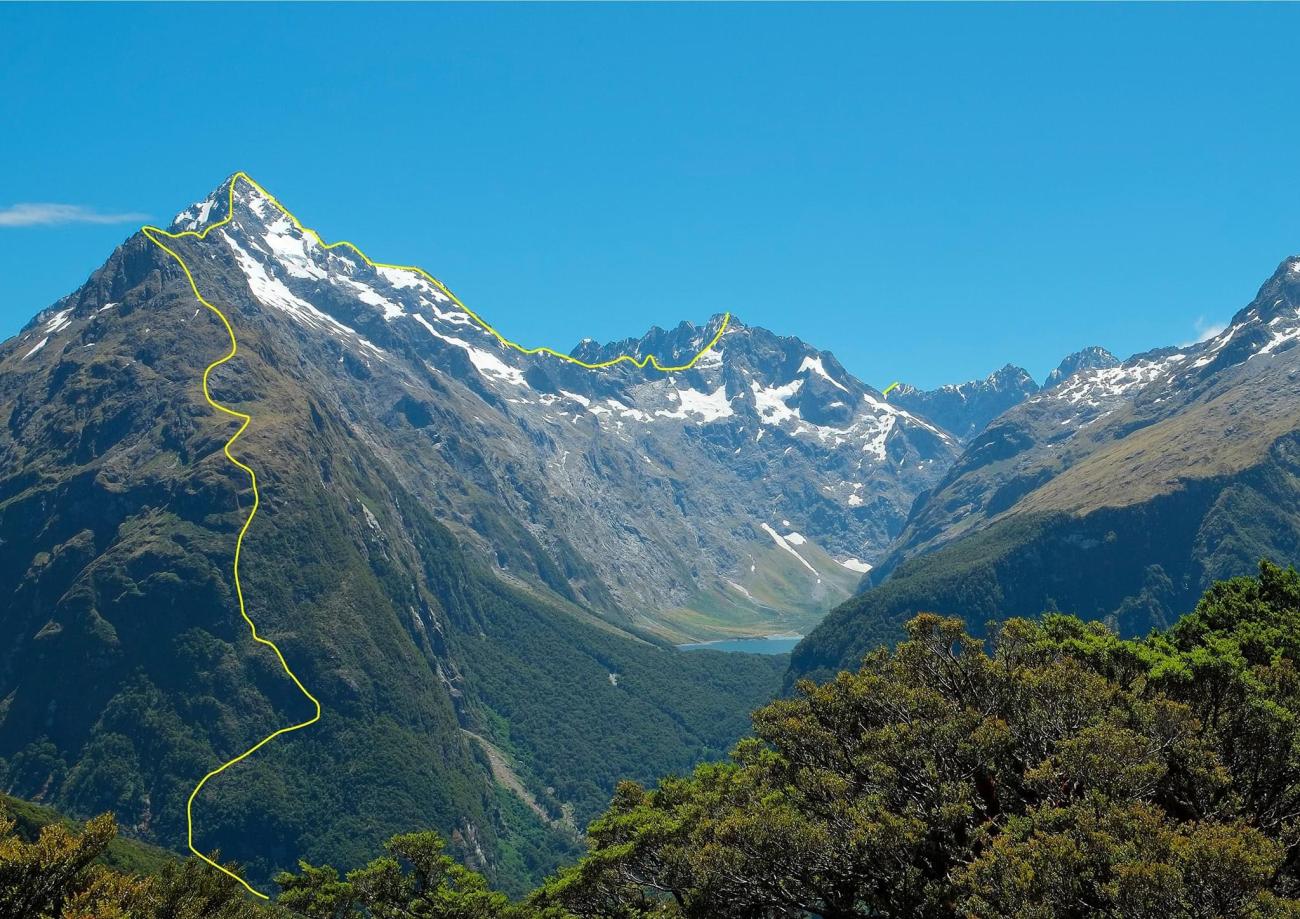
Cross the Lake Marian Track Bridge off the Hollyford Road and go directly through the forest to the base of the ridge. The initial ridge was climbed to above the bluffs by Milton Bardsley and Ian Cameron in January 1964.
Follow a vegetated weakness left (south) under obvious cliff, then back right, then left again to reach the bush line (about 4 hrs). Then follow the ridge for about 9km to all summits.
The black cliff with slabby base that protects the final part of the east ridge to the true summit was bypassed to the north on the first ascent but has been climbed direct at grade 16.
There is a good bivvy platform on the west side of the ridge about 200m north of the summit.
The photo is from Key Summit and shows the line of first ascent (which also took in Mt Crosscut and Barrier Peak). There is a descent to Cirque Creek from near Christina’s north peak.
- P1
- Alpine (Commitment) IV
- Alpine (Technical) 3
'Final black cliff' climbed directly, Jan 2022 via crack directly on ridge (6m, ~16) up first step, thereafter weaving just each side of ridge on subsequent easier steps. overall, the east ridge is a mammoth outing , aesthetic and with a big mountain feel, but marred by sustained loose rock and we (respectfully) felt deserved a lower star rating. Did without rope/rack/stove but all would be nice in places; with rope and handsized cams there is a stonking vertical corner crack in the black cliff,maybe 15-20m pitch.