Map
Routes
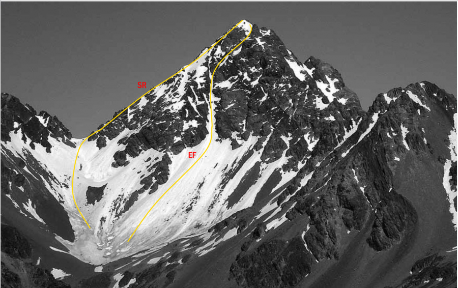
| Reference | Title | Grade | Length | Pro | Quality | Alert | Operations |
|---|---|---|---|---|---|---|---|
| SR | SRSouth Ridge, 2- | 2- | 0m | ||||
Follow Trojan Stream or Alma Stream, directly to Alma Col and climb loose rock straight up from the col. A |
|||||||
| EF | EFEast Face, 2+ | 2+ | 0m | ||||
From the head of Alma Stream follow a snow gully directly to the summit. Not often in condition. |
|||||||
| North East Ridge, 1+ | 1+ | 0m | |||||
From Alma Stream climb to a prominent col on Alma Spur at 2100 metres, west of Pt 2205 |
|||||||
| North Face | 0m | ||||||
From Balaclava Basins at the head of The Growler follow a prominent east-trending gut leading |
|||||||
| West Ridge | 0m | ||||||
From Balaclava Basins at the head of The Growler, take a steep couloir leading to a col on the |
|||||||
in association with the Canterbury Mountaineering Club