Pick a route up through the bluffs between Raspberry and Big Creeks, to gain the easy leading ridge. 200 to 300 metres below the summit a steep gut is crossed to give access to a better ridge on the south west side, which is then followed to the summit. The final 50m or so are on relatively exposed slabs. For permission to cross farmland you must contact Mt Aspiring Station manager Randall Aspinall, 03 443 7155.
Start up the tussock and bracken slopes directly behind Raspberry Hut. After about one hour the ridge becomes well defined and eventually leads to a col (1750m) on the Shotover-Matukituki divide. From this col follow a deer trail south for several hundred metres, until the south ridge is crossed and a prominent snowfield on the South Face is reached. The snowfield is then climbed to the summit. This route would take about six to seven hours from Raspberry Flat.
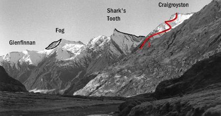
The North East Ridge is reached from the col at the head of Raspberry Creek and consists of a steep climb on shattered rock, with some delicate and unprotected moves, as only this type of climbing can deliver, necessary near the top.