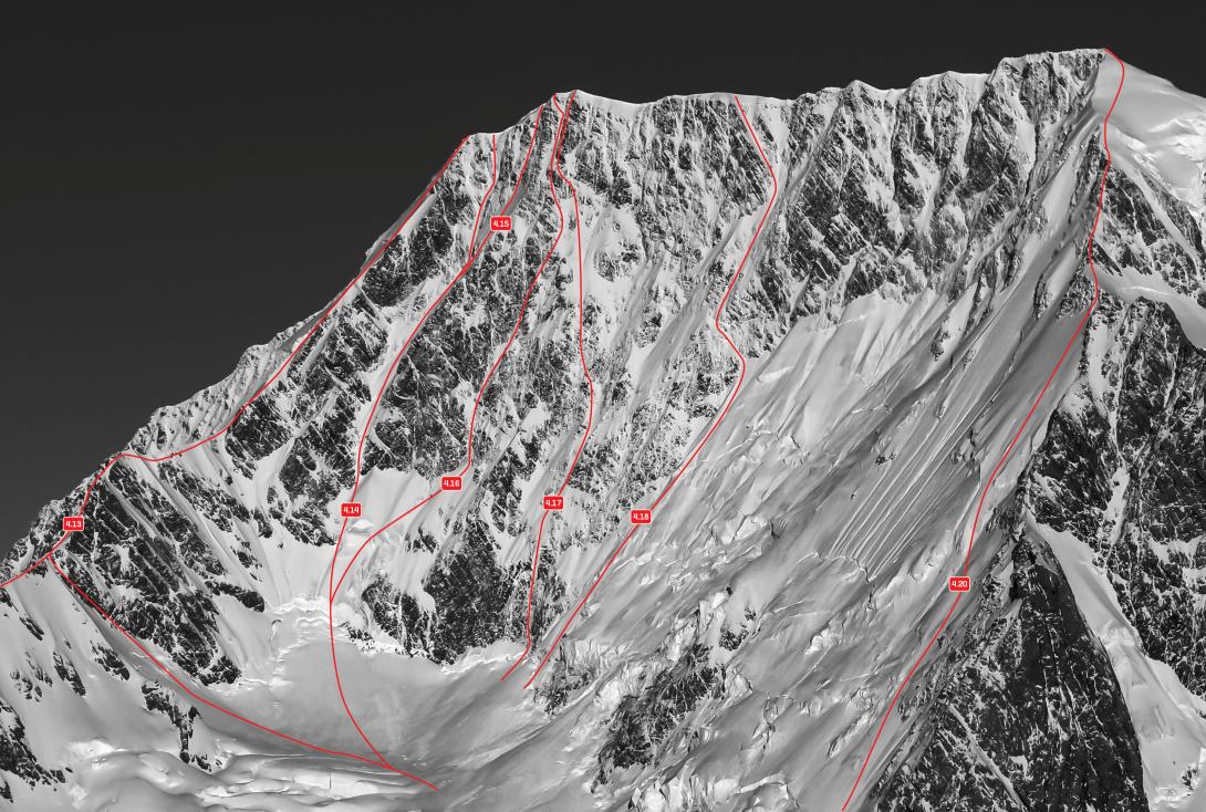
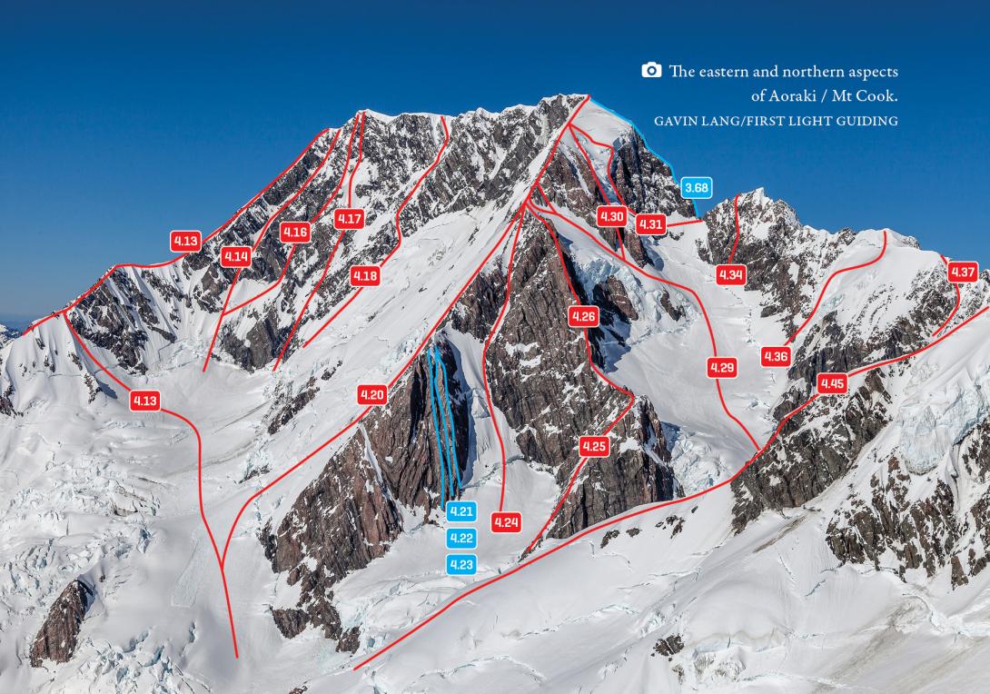
Many variations exist on this 1600m high face. The routes are long sustained ice climbs and can involve high objective danger from rockfall. In 1991 a major rock avalanche swept down the face below High Peak, lowering its height by 10m. The debris jetted across the Plateau, spewed down the Hochstetter Icefall, across the Tasman Glacier and slightly up the moraine wall on the other side of the Tasman Valley.
Routes
| Reference | Title | Grade | Length | Pro | Quality | Alert | Operations |
|---|---|---|---|---|---|---|---|
| 4.14 | 4.14Great Gully, V,4,5 | V,4,5 | 0m | ||||
|
A prominent route parallel to the East Ridge.
A prominent route parallel to the East Ridge. A right side variant of the Atkinson/Hall line exists, finishing on Middle Peak. |
|||||||
| 4.15 | 4.15 Great Gully Variant, V,4 | V,4 | 0m | ||||
|
A right side variant of the Great Gully, finishing near Middle Peak.
|
|||||||
| 4.16 | 4.16Rumblestiltzskin, VII,5+,6,WI4,M5 | VII,5+,6,WI4,M5 | 0m | ||||
|
This is the central gully between two prominent arêtes when viewed from a distance. The first ascent required three bivvies. No known repeats.
|
|||||||
| 4.20 | 4.20Zurbriggen Ridge, IV,3+ | IV,3+ | 0m | ||||
|
A classic route from a historical perspective, but it’s really a long grind that gets a lot of early sun. Begin by climbing snow slopes on the edge of the lower east face. The original route gained the ridge 400m above the Plateau, up a step of poor rock, then up the rocky ridge interspersed with snow slopes to gain the Summit Rocks, where the Linda Glacier route intersects.
|
|||||||
| 4.17 | 4.17Boogie 'Til You Puke, VII,5+,17,6 | VII,5+,17,6 | 0m | ||||
Ascend mixed ground on icefields and rock ribs between the large gully on the left of the face and the Jones Route. Finishes up the rightmost of two prominent arêtes directly to Middle Peak (crux grade 17—the highest rock climbing in New Zealand). |
|||||||
| 4.18 | 4.18Jones Route, VI,4,4+ | VI,4,4+ | 0m | ||||
|
From the large shelf below the face, head 900m up the left edge of the large snow face, then out on a ramp leading left and up, joining the summit ridge just north of the Middle Peak. Murray returned and climbed the direct finish with Vicky Thompson.
|
|||||||
| High Peak Route, 4+ | 4+ | 0m |
|
||||
|
This (was) the standard route on the East Face. From the shelf near Zurbriggens ascend left towards the south side of two prominent buttresses (variations ascend the buttresses when the rocks are not iced up), then up slopes to the left of the buttresses and through the rock band to reach the summit ridge either just below the summit or direct to the summit itself.
This route, and variations of it, were obliterated by the 1991 rock avalanche. |
|||||||
| 4.19 | 4.19Right side, V,3 | V,3 | 0m | ||||
|
aka The Skiers route. These days, a much easier alternative branches out right to the shelf above the summit rocks and is popular with the skiing fraternity these days.
|
|||||||