Type
Altitude
2502m
Part of
Image
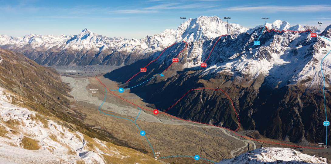
Caption
Lower Malte Brun Range and Murchison River flats, May 2017
Rights credit
Nina Dickerhof
Lat/lon
-43.61048,170.253012, NZ Topo Map
Topo50
BX16 783 677
Accessed from
Routes
| Reference | Title | Grade | Length | Pro | Quality | Alert | Operations |
|---|---|---|---|---|---|---|---|
| North East Ridge, I,2 | I,2 | 0m | |||||
|
A straightforward ascent from Dorothy Stream.
|
|||||||
| South West Ridge, I,2 | I,2 | 0m | |||||
|
A straightforward ascent from Dorothy Stream.
|
|||||||
| 6.03 | 6.03East Rib, II,3 | II,3 | 0m | ||||
|
From the Murchison flats, begin at the stream 800m down valley from Burnett Stream. Head up the stream to about 1200m, climb north-east onto a ridge, then drop down steep scree to reach Burnett Stream at about 1300m. From the Burnett Stream basin, ascend the central of three prominent ribs to reach the main range about 250m south of the summit.
|
|||||||
Comments
This place appears in
Attribution
ATP 2018 (Rob Frost)
UUID
399a8e67-c3a0-43ee-b8a6-e9cce4df8e80