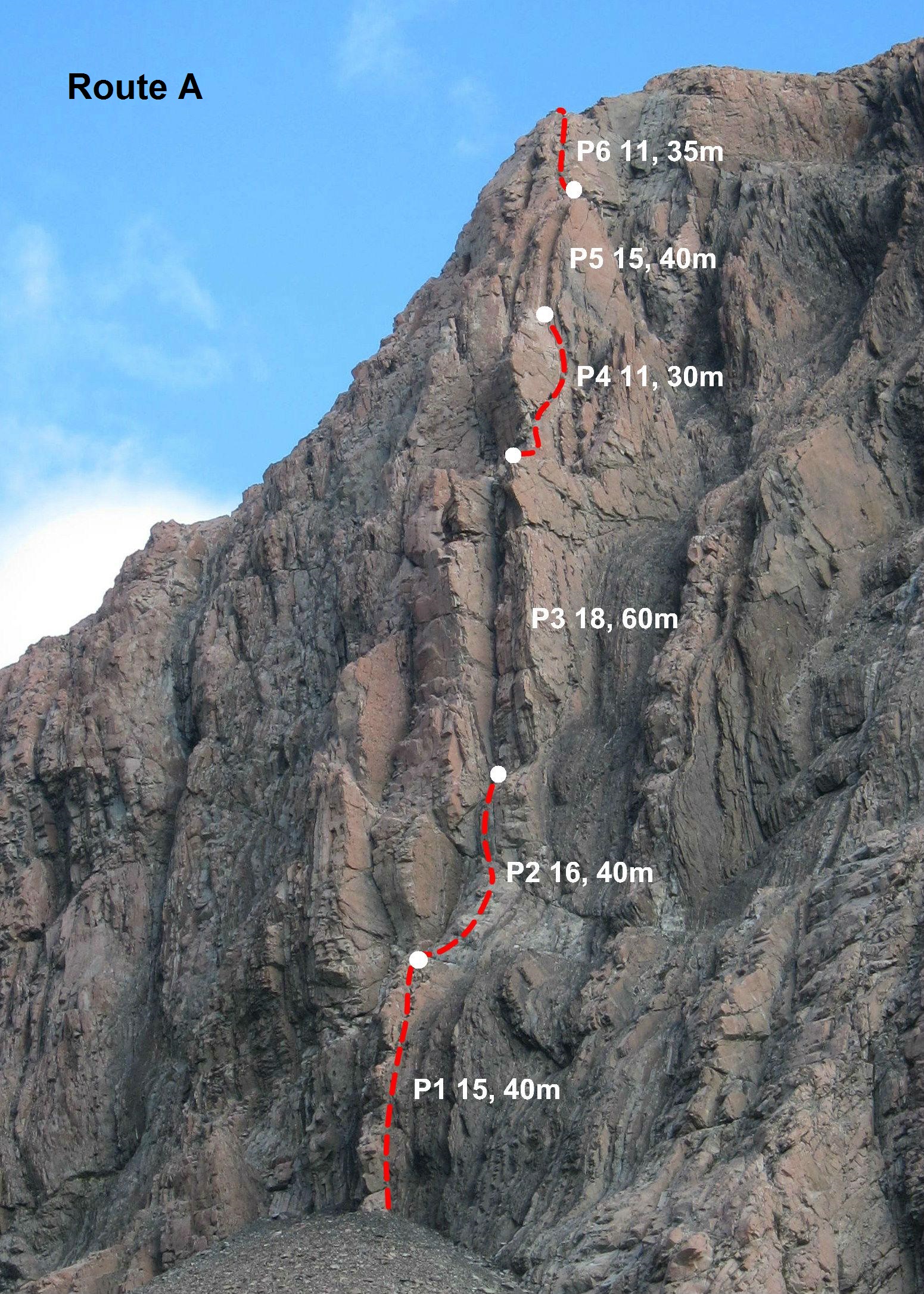
Takes the skyline pillar (as viewed from the confluence of the Reay and Walpole Streams in the Reay Valley) via a series of corners and arêtes to the lower North West Ridge of Mt Johnson. Six or seven pitches of generally good quality rock with some exposed climbing, good protection and a really nice topout ledge before an easy-angled scramble to point 2235m.
To access the route from the upper Reay valley, continue sidling on the true right of the Reay Stream until a crossing point is reached a short way above an impressive chasm.
Descend by heading south along the Northwest Ridge to a col and then dropping down scree and easy-angled snow to the upper Reay Valley.
- P1
- 15
- 40m
- Trad
Climb the right side of a pink column just left of an eroded grey streak to finish at a large belay ledge.
- P2
- 16
- 40m
- Trad
Trend left up slabby terrain to a shallow vertical corner. A couple of strenuous moves lead to a sloping ledge at the base of the main corner.
- P3
- 18
- 60m
- Trad
Up the main corner to a sitting belay ledge. Pitch could be split in two if climbing on 50m ropes.
- P4
- 11
- 30m
- Trad
Up a short face to an arête then follow a large crack diagonally up and right.
- P5
- 15
- 40m
- Trad
Climb the shallow and exposed rightward-trending corner.
- P6
- 11
- 35m
- Trad
Up a shallow, cracked groove then follow the prow to topout on a flat ledge with fantastic views of the valley and peaks above the Grand Plateau.

Good to see a decent topo and good descriptions added.