
Mt Copland

Type
Mountain
Altitude
2331m
Part of
Lat/lon
-43.59796307,170.02436054, NZ Topo Map
Topo50
BX15 598 685
Image
Caption

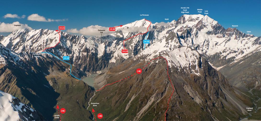
The Strauchon and upper Copland valleys from Tekano Peak, December 2012 

Rights credit
Rob Frost/Subalpine Photography

Routes

Reference Title Grade Length Pro Quality Alert Operations
14.15 14.15Aurora Ridge, III,2+ III,2+ 0m
1.02

This ridge affords spectacular views of the Strauchon valley. From Darkwater Saddle, follow the ridge north-east, passing rock steps using slabs and snow slopes on the west side of the ridge. The final 100m to reach the Navigator Range crest involves steep snow and usually a schrund or two, but there are a few options here. Traverse snowfields on the north side of the range to reach the summit, which is actually Pt 2331m.


  • P1
  • Alpine (Commitment) III
  • Alpine (Technical) 2+


Add Place Add Route
Comments
Attribution
ATP 2018 (Rob Frost)
UUID
 
e53ef196-1b4d-4c24-95ef-192260b3c3bd