
The Fang

Type
Mountain
Altitude
2081m
Part of
Lat/lon
-43.597178,169.999975, NZ Topo Map
Image
Caption

Welcome Flat and Navigator Range peaks above the Ruera catchment

Rights credit
Danilo Hegg/Southern Alps Photography

Routes

Reference Title Grade Length Pro Quality Alert Operations
14.13 14.13From Lyttle Glacier, II,2+ II,2+ 0m
0

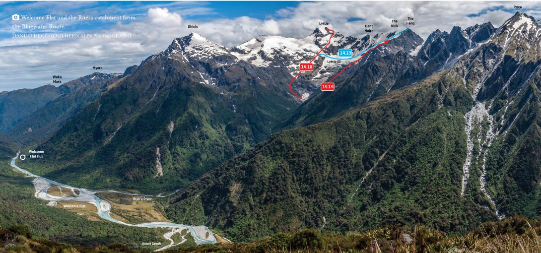
From the Lyttle Peak High Peak approach route, cross the Lyttle Glacier névé and then climb to the col between The Nick and The Fang. A snow slope and 50m of easy angled but rotten schist lead to the summit. A great viewpoint.


  • P1
  • Alpine (Commitment) II
  • Alpine (Technical) 2+


14.14 14.14Crumbling Ridge, II,2+ II,2+ 0m
1.02

Beginning from a delightful tussock basin at 1000m above the Darkwater–Lyttle confluence, this route generally comprises straightforward snowgrass, rock, and snow slopes, apart from an 80m section of steep slabs around 1600m. Stay on the north-west side of the ridge above 1500m. The final summit block is best tackled by traversing around the west side to the northern slopes.


  • P1
  • Alpine (Commitment) II
  • Alpine (Technical) 2+


Add Place Add Route
Comments
Attribution
ATP 2018 (Rob Frost)
UUID
 
81125047-825c-4594-a1ab-9e8fd2726319