Type
Altitude
2286m
Part of
Image
Caption
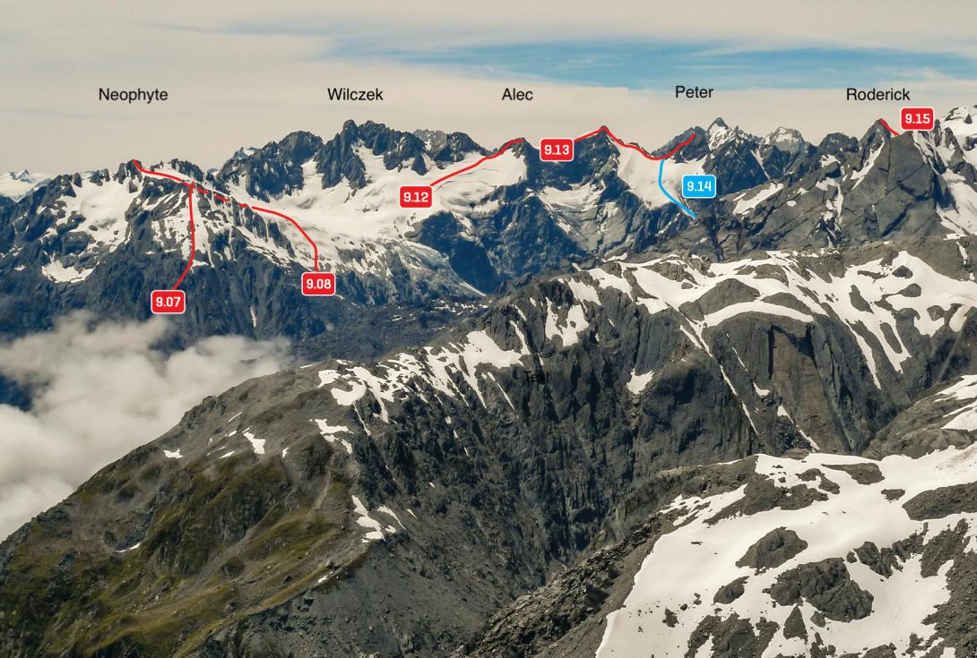
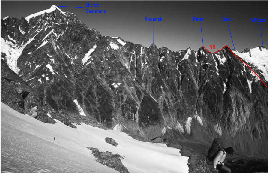
Western aspects of Maximilian Range from Goatpath Ridge (Baird Range), January 2015
Rights credit
Rob Frost/Subalpine Photography
Lat/lon
-43.457779,170.345249, NZ Topo Map
Topo50
BX16 852 849
Accessed from
Routes
| Reference | Title | Grade | Length | Pro | Quality | Alert | Operations |
|---|---|---|---|---|---|---|---|
| East Face, 1+ | 1+ | 0m | |||||
|
From Whymper Hut, follow the gully draining between Mt Wilczek and Mt Alec, then snowfields beyond Pt 1573 metres up towards the Maximilian Range. The Maximilian Range and snow slopes on it can now be followed south over Pt 2328 metres to Mt Peter.
|
|||||||
| 9.13 | 9.13Traverse from Mt Alec, III,2+ | III,2+ | 0m | ||||
|
Gain the ridge south of Pt 2296m, from where a short easy climb leads to Mt Alec. The first ascent party to traverse from Mt Alec to Mt Peter via Pt 2328m reported no difficulties.
|
|||||||
| 9.14 | 9.14West Face, III,3 | III,3 | 0m | ||||
|
From the Burton Glacier, climb steep slabs to reach the snowfield between Pt 2328m and Mt Peter, from where the climbing is straightforward to the summit.
|
|||||||
Images
Comments
This place appears in
Attribution
ATP 2018 (Rob Frost)
CW Alps 2009 (Geoff Spearpoint, Yvonne Cook, CMC)
CW Alps 2009 (Geoff Spearpoint, Yvonne Cook, CMC)
UUID
ec1bb082-0cf5-4df6-8cab-2cbaa341eb53