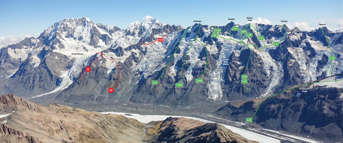
Map
Routes
| Reference | Title | Grade | Length | Pro | Quality | Alert | Operations |
|---|---|---|---|---|---|---|---|
| 5.08 | 5.08South East Face, IV,3+ | IV,3+ | 0m | ||||
|
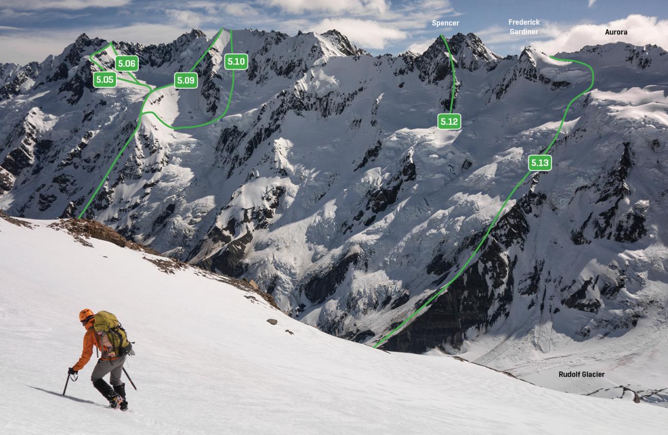
Climb scree slopes and a rotten rock ridge onto Emas Dome, then drop onto the Forrest-Ross Glacier névé and find a route up the face through the schrunds.
|
|||||||
| 5.09 | 5.09East Ridge, IV,3 | IV,3 | 0m | ||||
|
Climb scree slopes and a rotten rock ridge onto Emas Dome, then climb up the elegant arête of the east ridge to the summit.
|
|||||||
| 5.10 | 5.10East Face, IV,3+ | IV,3+ | 0m | ||||
|
Climb scree slopes and a rotten rock ridge onto Emas Dome, and descend north to a small névé between Emas Dome and Frenchay Col. Then climb the wide corridor of snow and ice north of the East Ridge.
|
|||||||
| West Ridge, 3+ | 3+ | 0m | |||||
Rises in a series of rock towers inter-connected by snow ridges. Possibly a safer and more enjoyable alternative to the West Face, offering a view onto the face for descent purposes. Deceptively good. |
|||||||
| West Face, 2+ | 2+ | 0m | |||||
From the Explorer Névé ascend the snowface directly to the summit, avoiding icecliffs and schrunds where necessary. This route is subject to avalanches, particularly in the afternoon. Late in summer the route can become cut off due to crevasses and schrunds. The rock rib on the right, below the Glacier-Douglas col, can provide alternative access to the snowslopes. The summit of Glacier Peak and the ridge near, can become dangerously corniced. Otherwise a straightforward climb, providing good access to and from Douglas. |
|||||||
Images