Type
Mountain
Altitude
2330m
Part of
Map
Accessed from
Image
Caption
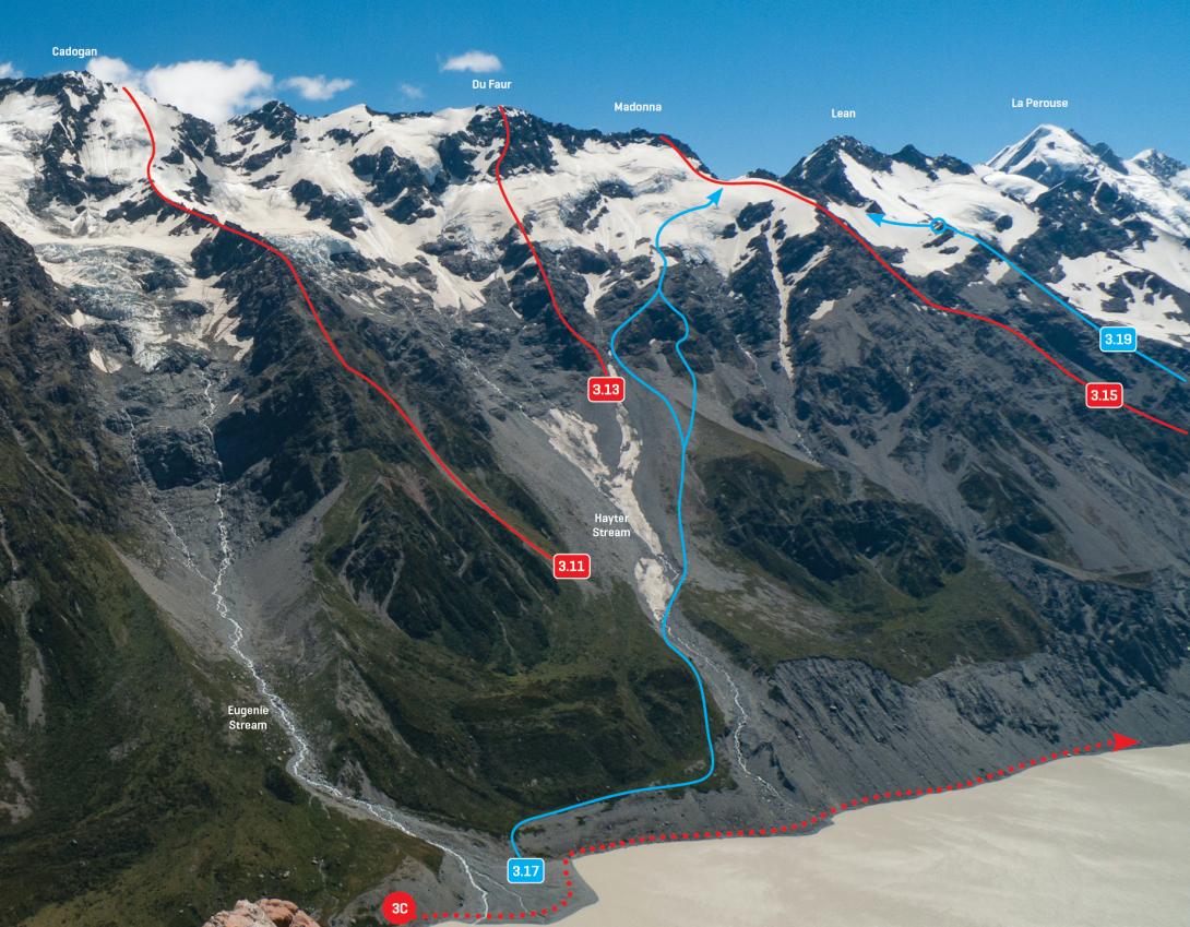
Main Divide above Hooker Lake, January 2013
Rights credit
Rob Frost/Subalpine Photography
Routes
| Reference | Title | Grade | Length | Pro | Quality | Alert | Operations |
|---|---|---|---|---|---|---|---|
| 3.13 | 3.13Hayter Buttress, III,3 | III,3 | 0m | ||||
|
Via the ridge between the Stewart and Hayter Glaciers (separating the two tributaries of Hayter Stream) and then via a rock buttress to the summit.
|
|||||||
| Cadogan–Madonna Ridge, II,1+ | II,1+ | 0m | |||||
|
A straightforward, scenic ridge.
|
|||||||
| West Ridge, II,3- | II,3- | 0m | |||||
|
Access the lower west ridge from the Copland Valley track and scramble at
|
|||||||
Comments
This place appears in
Attribution
ATP 2018 (Rob Frost)
UUID
c1b40afd-c962-4505-8c9c-815194ef3002