Type
Mountain
Altitude
2449m
Part of
Map
Accessed from
Image
Routes
| Reference | Title | Grade | Length | Pro | Quality | Alert | Operations |
|---|---|---|---|---|---|---|---|
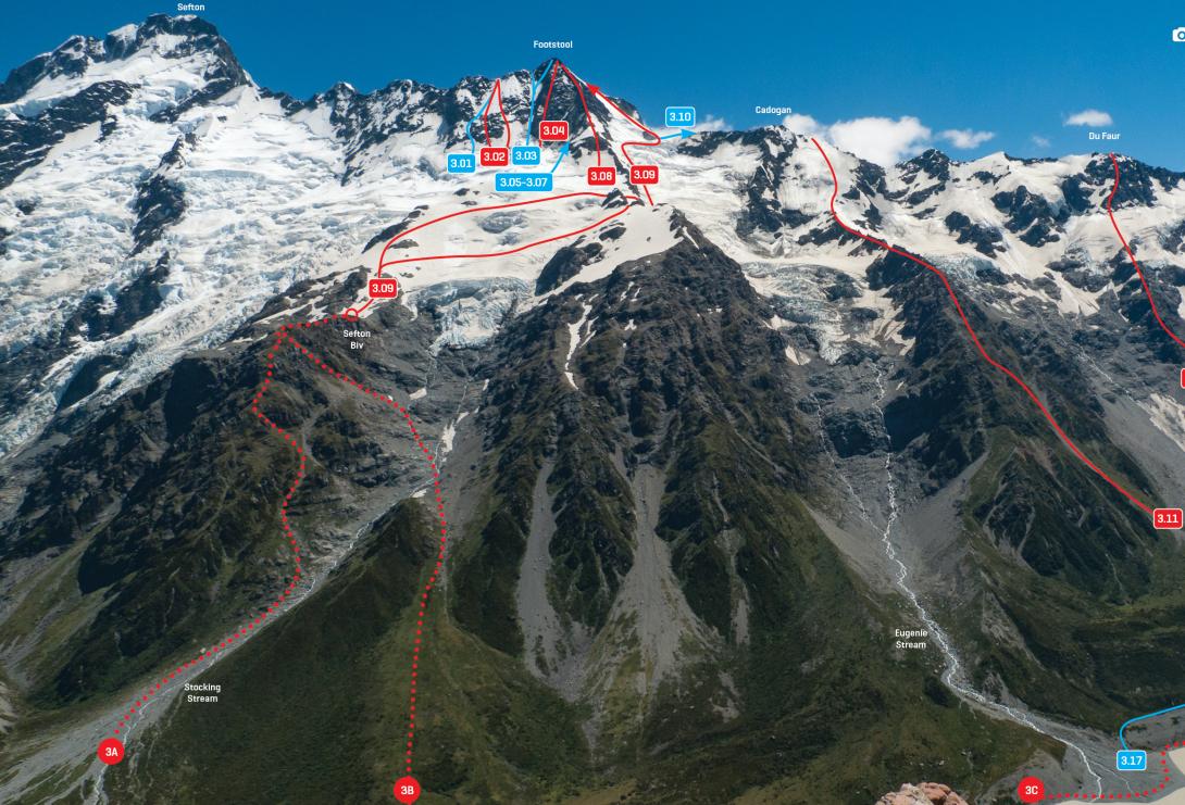
| 3.10 | 3.10South West Ridge, II,2 | II,2 | 0m | ||||
|
Travel as per the Main Divide route on The Footstool as far as the crest of the Divide, then an easy ridge to the summit.
|
|||||||
| 3.11 | 3.11East Ridge, III,3 | III,3 | 0m | ||||
|
Via the rock ridge between the Eugenie and Hayter Glaciers, then a rib right of centre on the east face. Either gain the ridge from Sefton Bivvy by crossing the east ridge of The Footstool and the Eugenie Glacier, or climb all the way from the valley floor (a true adventure). The upper part of the climb is a bad area for slab avalanches early in the summer.
|
|||||||
| Du Faur–Cadogan Ridge, II,1+ | II,1+ | 0m | |||||
|
A straightforward ridge that passes over an attractive unnamed peak (Pt 2352m).
|
|||||||
Comments
This place appears in
Attribution
ATP 2018 (Rob Frost)
UUID
9857c08c-f78e-4b94-bcec-f10770c8051d