Type
Mountain
Altitude
2089m
Part of
Map
Accessed from
Image
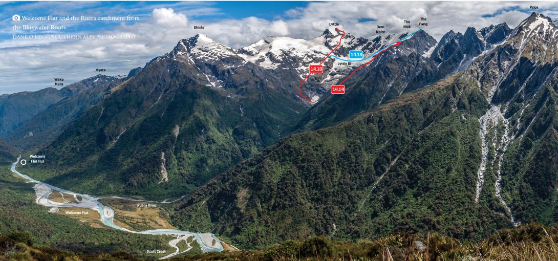
Caption
Welcome Flat and Navigator Range peaks above the Ruera catchment
Rights credit
Danilo Hegg/Southern Alps Photography
Routes
Comments
This place appears in
Attribution
ATP 2018 (Rob Frost)
UUID
c651db8f-6339-4226-a62b-f74e7fc615de