Type
Altitude
2046m
Part of
na
Lat/lon
-43.106623,170.884609, NZ Topo Map
Topo50
BW18 279 252
Accessed from
Routes
| Reference | Title | Grade | Length | Pro | Quality | Alert | Operations |
|---|---|---|---|---|---|---|---|
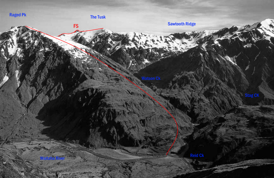
| FS | FSFrom the South, 1- | 1- | 0m | ||||
The Tusk is easily approached along the ridge from Raged Peak and the Reid–Stag Creek forks. |
|||||||
| Dickie Ridge, 1+ | 1+ | 0m | |||||
This long ridge can be traversed from Dickie Spur Hut to the Tusk but the rock is loose, there are pinnacles to negotiate and parts of the ridge are quite exposed |
|||||||
| From Top Tuke Hut, 1+ | 1+ | 0m | |||||
Head up valley from the hut and take the true-left lower fork that is closest to the 1020-metre contour. With snow in the gully, this offers reasonable travel to near Dickie Ridge, when access to the gentler upper snow slopes can be gained. |
|||||||
Comments
Attribution
Yvonne Cook and Geoff Spearpoint,
in association with the Canterbury Mountaineering Club
in association with the Canterbury Mountaineering Club
UUID
de378083-331b-4484-8f1a-19473da5af4c
