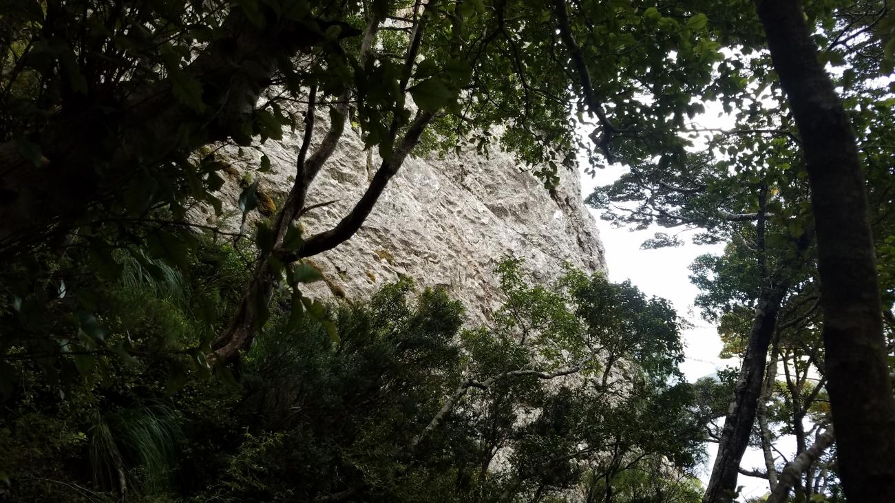
A crag of long, highly featured low-mid grade sport routes, on a conglomerate of rounded granite holds & knobs in a (relatively) strong sandstone matrix. Very funky rock, sporting jugs, slabs and slopers.
Map
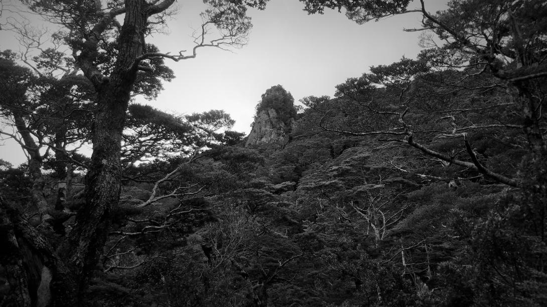
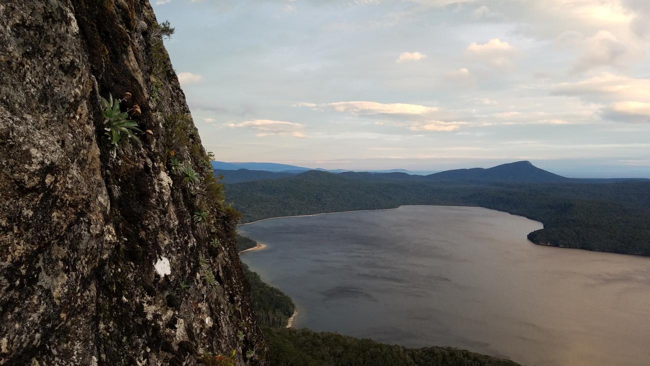
Take the Lake Hauroko Lookout track to it's top. From the wharf at the bottom, and when 15mins from the top, a steep thumb shaped plug of rock is obvious sticking out of the forest; this is The Anemometer, with current routes on the West face. From the Hauroko Lookout (The track is incorrectly marked on NZ Topo maps; the lookout is at point .556), it's another 10mins. An obvious game trail leads horizontally West across a treed ridge, until becoming vague as the ridge broadens, when almost at the crag. Follow you nose and pink flagging another 80m along the broad ridge, then another 80m down left to the crag, visible through the trees. Routes start from the saddle where you arrive, and on the West side. A treed gully leads down the side of the cliff; pay attention to your left for faint trails and handlines to the individual routes. Using a GPS map and the crag co-ordinates; and/or the map screenshot attached may be helpful.
Routes
| Reference | Title | Grade | Length | Pro | Quality | Alert | Operations |
|---|---|---|---|---|---|---|---|
| Lady of the Lake, 15 | 15 | 25m | 1 |
||||
|
The mountaineers special. The North ridge of the anemometer, from the saddle where you drop your pack. A one move wonder, with one protection bolt, then a highly runout scramble to a single bolt near the top. Anchor here (back up with a long sling around giant rock bollard above), or higher up using blocks (caution loose rock). Abseil 30m down and left from the top anchors of 'Haunted', visible 5m down the West side slabs from the first summit (exposed scrambling to gain anchors!).
|
|||||||
| Storm Warning, 16 | 16 | 20m | 10 |
||||
|
Storm warning and Ultrasonic are the first two routes encountered on the West Face, about 15-20m along from the saddle / Lady of the Lake. Walk down the West Gully and watch for faint track going up an right to a narrow belay platform. Storm Warning is the left hand route. Independent anchor (DBA).
|
|||||||
| Ultrasonic, 18 | 18 | 27m | 10 |
||||
|
Slab to steep wall on fantastic holds, finishing with more slabby moves to join Haunted 2b from the top. A quality direct (lower) start could be added with 2-3 bolts.
|
|||||||
| Beaufort Nine, 19 | 19 | 45m | 15 |
||||
|
Directly up the steep rock in the center of the West Face, left of the 'Haunted...' arete. Fantastic movement. Belay second up to you, rap down and true right (knot the ends of your rope!) to make the ground with one 60m rope. Rapping directly down won't make it.
|
|||||||
| Haunted by Waters, 20 | 20 | 50m | 16 |
||||
|
The Long, knobby arete framing the right end of the West Face, giving way to lower angled but thin climbing up and left to the top of the Anemometer. Several cruxes. Bolt spacing is generous in places. The giant jug at the apex of the arete can be passed on the left (1b), or right (2b, recommended). Belayer can clip to first bolt, but better positioning is down on the forest floor, at bottom of the (optional) access handline - the climbing is engaging right off the deck. From the top, Belay second up to you, then rap down and true right (knot the ends of your rope!) to make the ground with one 60m rope. Rapping directly down won't make it.
|
|||||||
| Urupa, 19 | 19 | 3 |
|||||
|
A superior 3b variation start to Haunted, climbing directly through the initial overlaps. Access via handline (right hand of 2) from forest floor.
|
|||||||
Images
.")