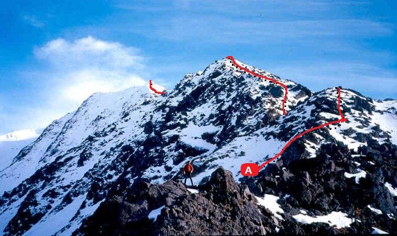
Mt Weld

Type
Altitude
2114m
Part of

Named for Frederick Weld, who in March 1855, with Alphonse Clifford, climbed onto a high point on Turk Ridge and spotted Tarndale, which led to the upper Clarence and opened up the important droving route to Canterbury.

Image
Lat/lon
POINT (172.85497071 -42.0980163)
Topo50
BS25 880 393
Accessed from
Add Place Add Route

Routes

Reference Title Grade Length Pro Quality Alert Operations
A ASouth East Ridge, 2 2 0m
0

  • P1
  • Alpine (Technical) 2

From the Hydro Rd. Follow a 4WD track to power pylons on the end of the spur. Pleasant ridge scrambling leads to a difficult notch at about 1950m. Turn it by descending steep slopes on the east, crossing a gully and climbing up the final easy slopes to the summit. There are easy descent routes via scree and tussock into streams on either side of the ridge.


Comments
Attribution
Ben Winnubst
UUID
 
d853ee38-5662-4789-aa2f-88b0b31c5f20