James Westland, (Jims Knob in the Ramsay) a friend of the surveyor GJ Roberts, visited the Rakaia in March 1893.
Routes
| Reference | Title | Grade | Length | Pro | Quality | Alert | Operations |
|---|---|---|---|---|---|---|---|
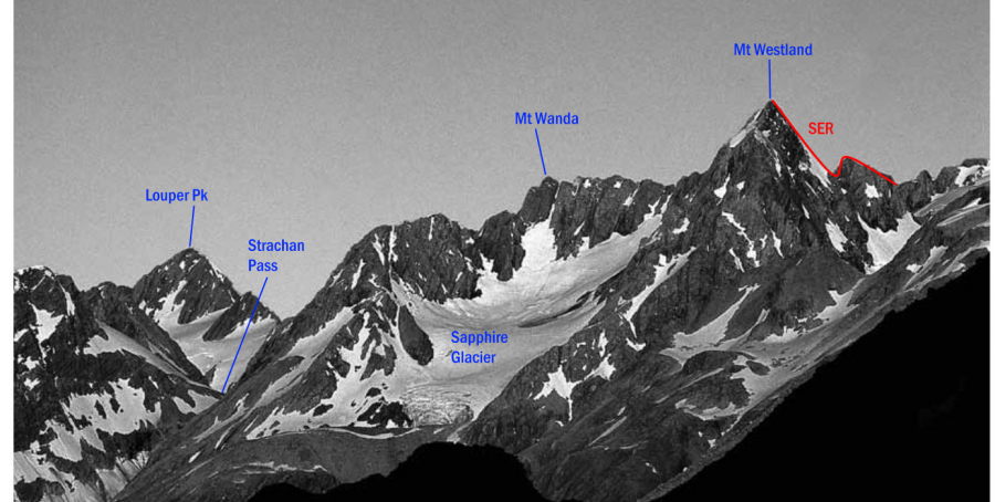
| SE | SESouth East Ridge | 0m | |||||
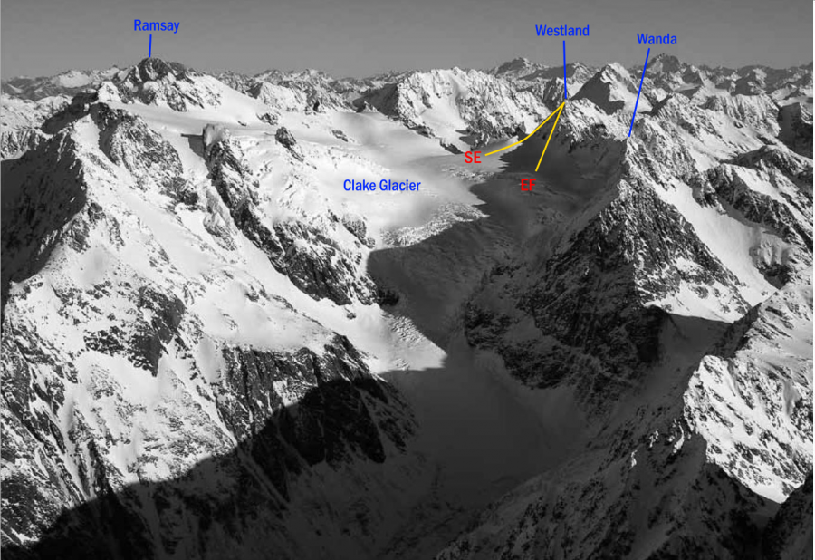
From the upper Cockayne Glacier find a suitable crossing point to the Clarke Glacier between Mt Ramsay and Pt 2332 metres and continue to the South East Ridge. From here, follow steep good rock initially, then loose rotten rock as the ridge eases. |
|||||||
| West Ridge, III,3 | III,3 | 0m | |||||
|
Climbed as part of a Transalpine thru-trip with a multiday pack (including rack and rope, unused here). From a camp on a beautiful plateau a few hundred meters up the spur NE of Swift Water (1-person enclosed bivvy rock, or marginal 2-person shelter rock), probably at 1570m, generally follow the ridge. Scrambling with some hard scrambling and some easy rockclimbing, often on good red sandstone greywacke. Gain 2264 by some good quality lower-grade rockclimbing, gained by move left of the ridge (exposed) then following a crack or line of weakness (exposed). Then downclimb into an exposed notch and along a sharp ridge to the summit. To descend, take a line to the beautiful Clarke Gl. neve blending the easiest terrain of the EF and (loose!) SE ridge, downclimbing WI2 waterice in one location. The first ascentionist then descended the Cockayne Gl. to the Rakia although the map indicates various possible descent options back towards the Lord.
|
|||||||
| EF | EFEast Face | 0m | |||||
From the Clarke névé directly under Mt Westland, scramble up firm and loose rock. |
|||||||
Images
in association with the Canterbury Mountaineering Club

