Mt Neave is named after the original occupant of Mt Algidus Station (then called Neave’s Station), who crossed Whitcombe Pass with Julius von Haast and Andreas Reischek in 1879.
Map
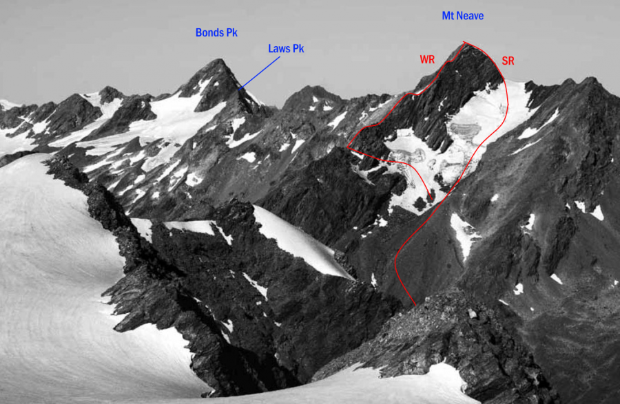
Routes
| Reference | Title | Grade | Length | Pro | Quality | Alert | Operations |
|---|---|---|---|---|---|---|---|
| SR | SRSouth Ridge, 2- | 2- | 0m | ||||
Head for the small permanent ice gully south-west of Mt Neave. Continue to the col and then |
|||||||
| WR | WRWest Ridge, 2- | 2- | 0m | ||||
From the Whitcombe Valley, reasonable tussock access to the gravel basins under the Main |
|||||||
| North West Face, 2- | 2- | 0m | |||||
The original party bashed up through bush from Cave Camp and, forsaking the ridge, headed |
|||||||
in association with the Canterbury Mountaineering Club