Type
Mountain
Altitude
2119m
Part of
Map
Accessed from
Image
Routes
| Reference | Title | Grade | Length | Pro | Quality | Alert | Operations |
|---|---|---|---|---|---|---|---|
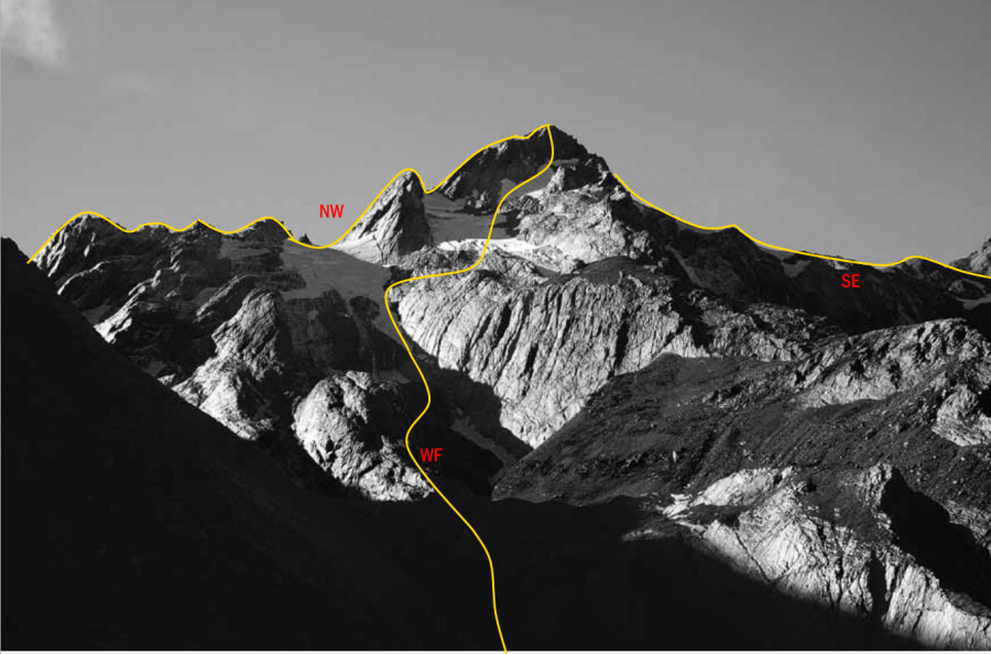
| NW | NWNorth West Ridge | 0m | |||||
Completed as part of a traverse along the Divide. The broken rocky ridge is time-consuming. |
|||||||
| WF | WFWest Face, 2 | 2 | 0m | ||||
Follow the steep creek on the south side of Mt Carl until a gap in the spur on the right allows |
|||||||
| SE | SESouth East Ridge | 0m | |||||
Completed as part of a traverse along the Divide. The broken rocky ridge is time-consuming. |
|||||||
Comments
Attribution
Yvonne Cook and Geoff Spearpoint,
in association with the Canterbury Mountaineering Club
in association with the Canterbury Mountaineering Club
UUID
e8b170c1-f322-4e02-9221-5284ca45f430