Type
Mountain
Altitude
2060m
Part of
Map
Accessed from
Image
Routes
| Reference | Title | Grade | Length | Pro | Quality | Alert | Operations |
|---|---|---|---|---|---|---|---|
| South Face, III | III | 0m | |||||
|
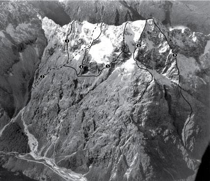
Cross the Hollyford River and climb the large scree fan to reach a gut leading to the foot of the south ridge of Christina’s high peak. Follow the rib on the true left of the gut. Early season snow provided
|
|||||||
| 8 | 8South West Ridge, III | III | 0m | ||||
|
From the bottom of Lyttle's Flat climb a gully onto the ridge just left of the rock scar. Follow the ridge to the first rock band, ascend the prominent white buttress on the left of the rock band, then move up right, keeping to good rock. Join the ridge at a short corner and cheval, and continue to the South Peak. Vass then climbed the south-west ridge to Christina’s high peak.
|
|||||||
Comments
Attribution
Craig Jefferies
UUID
c53a2771-23ba-4f5d-8a60-5d569fc4ac39