na
Map
Routes
| Reference | Title | Grade | Length | Pro | Quality | Alert | Operations |
|---|---|---|---|---|---|---|---|
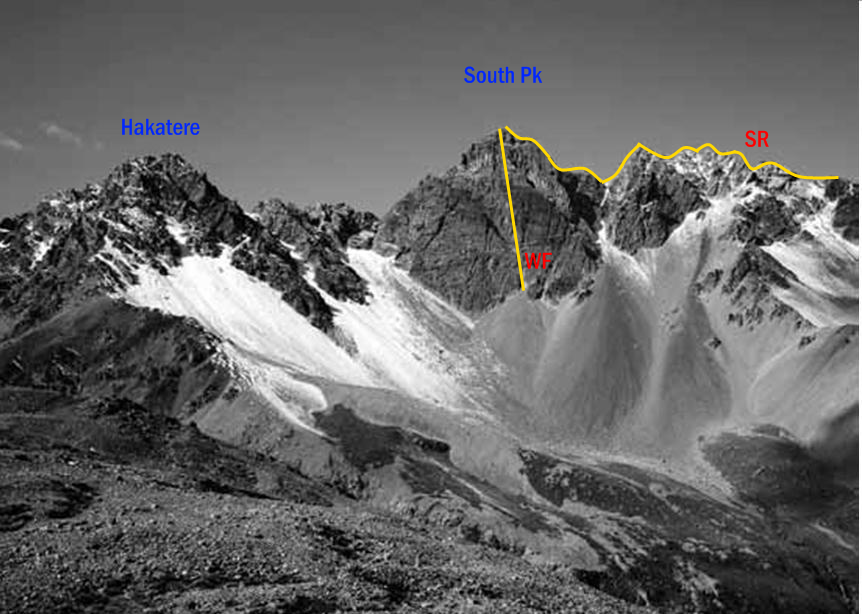
| WF | WFWest Face | 0m | |||||
The steep West Face is relatively easy to reach but only one route exists, a scramble |
|||||||
| SR | SRSouth Ridge, via Lawrence, 1+ | 1+ | 0m | ||||
Climb the spur on the northern side of the creek that joins the Lawrence River immediately |
|||||||
| SR | SRSouth Ridge, via Hakatere, 1+ | 1+ | 0m | ||||
Best attempted from the hanging valley that joins the main valley a short distance up the lateral |
|||||||
| North East Face, 1+ | 1+ | 0m | |||||
Follow the top of the lateral moraine above the Ashburton Glacier to the basin between South |
|||||||
| East Ridge | 0m | ||||||
Sidle into the basin below South Peak and head to a gut between the summit and the first gendarme |
|||||||
| North Ridge, 2 | 2 | 0m | |||||
|
From the col between Hakatere and South Peak, climb the ridge. 2 short
|
|||||||
in association with the Canterbury Mountaineering Club