Type
Altitude
2421m
Part of
Lat/lon
-43.33984441,171.04004118, NZ Topo Map
Topo50
BW18 411 996
Routes
| Reference | Title | Grade | Length | Pro | Quality | Alert | Operations |
|---|---|---|---|---|---|---|---|
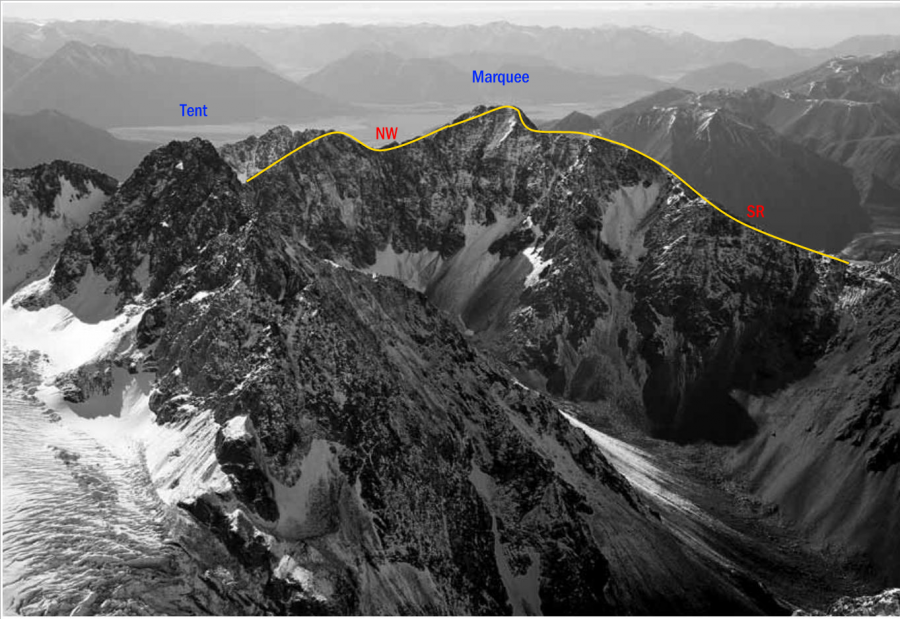
| NW | NWNorth West Ridge, 2 | 2 | 0m | ||||
From Peg Col this route is harder and much longer than the South Ridge, involving a steep scramble from the col with some route finding. The ridge eases off before the summit. |
|||||||
| SR | SRSouth Ridge, 1 | 1 | 0m | ||||
A slog along the ridge, encountering a false summit before the top. |
|||||||
| North West Ridge, via Washbourne Ck., 1 | 1 | 0m | |||||
Reach the ridge south-east of Pt 2347 metres and follow it to the summit. The ridge can also be reached via a small glacier east of Peg Col. |
|||||||
| West Face, 2 | 2 | 0m | |||||
The west face can provide much quicker access to the summit than the long south ridge. Snow slopes (up to 45 - 50°) up a broad couloir lead to the south ridge 200m south of the summit. Watch for rockfall, particularly out of a gully to climbers right near the bottom of the face. |
|||||||
Comments
Attribution
Yvonne Cook and Geoff Spearpoint,
in association with the Canterbury Mountaineering Club
in association with the Canterbury Mountaineering Club
UUID
cd362dc2-3132-4ef6-acee-61fb2cd2b492
