Map
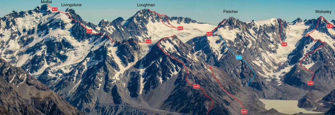
Peaks above the Grey and Maud Glaciers – Moffat to Wolseley, December 2011
Routes
| Reference | Title | Grade | Length | Pro | Quality | Alert | Operations |
|---|---|---|---|---|---|---|---|
| Northern Flank, II,2 | II,2 | 0m | |||||
|
Gordon has been climbed from above the Grey Icefall via the col to the north of Gordon. This probably offers the best descent option if the icefall is easily passable.
|
|||||||
| South West Ridge, II,2+ | II,2+ | 0m | |||||
|
Gordon has also been climbed from below the Grey Icefall up the south-west ridge. If the icefall is impassable then this could offer a strenuous route between the lower and upper Grey Glacier.
|
|||||||
| 8.31 | 8.31South East Ridge, II,2+ | II,2+ | 0m | ||||
|
Prior to recession of the Grey and Maud Glacier, access to this scenic ridge was straightforward. There is now a large, steep moraine wall. The best place to ascend this is unknown, but a route from the lower Grey may be possible at present. The ridge is a moderately steep scramble on loose rock. The south face may have been used to descend by the first ascentionists.
|
|||||||