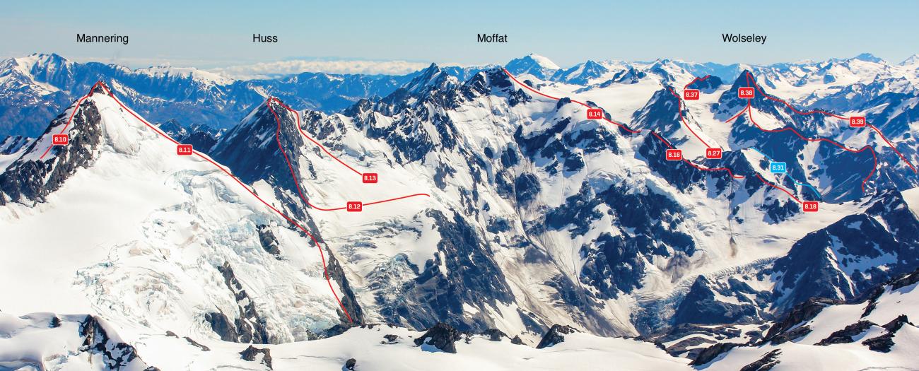
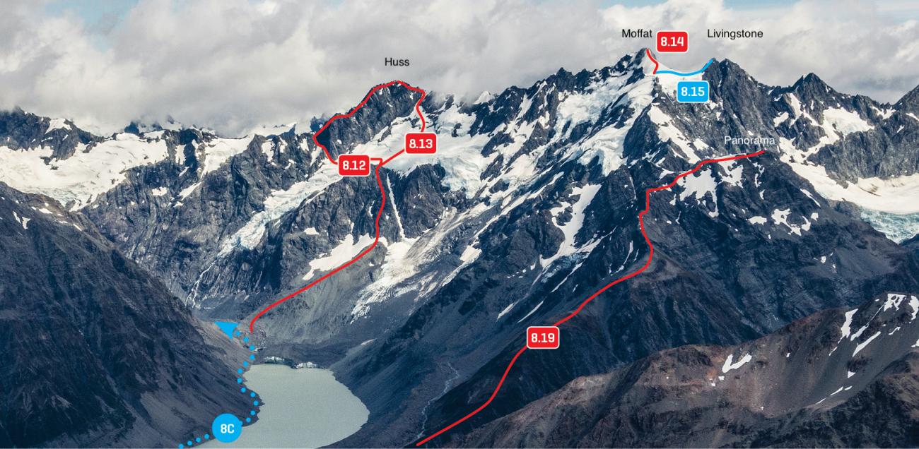
Map
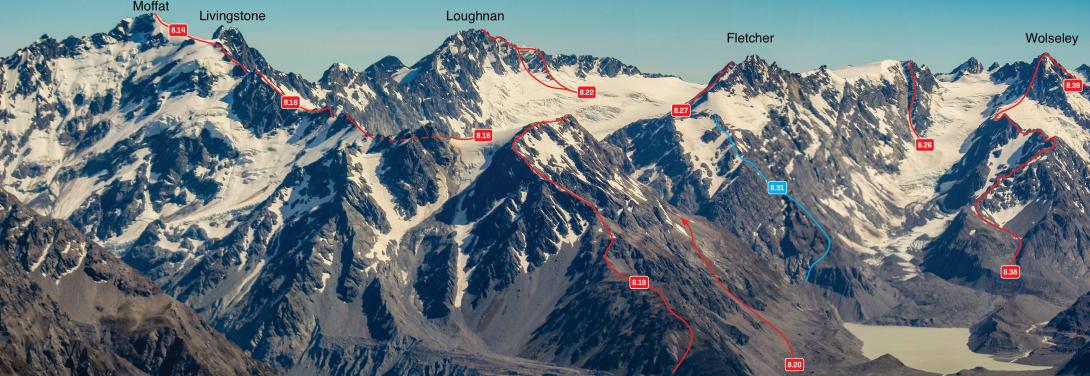
Peaks above the Grey and Maud Glaciers – Moffat to Wolseley, December 2011
Routes
| Reference | Title | Grade | Length | Pro | Quality | Alert | Operations |
|---|---|---|---|---|---|---|---|
| 8.14 | 8.14South East Ridge, III,2 | III,2 | 0m | ||||
|
Accessed via Panorama (route 8.19), Bruce Murray (route 8.18), and Upton Peak (route 8.16). Upton can be turned on the north-east side. Beyond Upton, the predominantly snow ridge involves a narrow section of loose, black rock that leads onto the southern flanks then onto the summit. Alternatively, the rock face can be climbed directly, leading to the summit. The South East Ridge is the best descent route from Mt Moffat.
|
|||||||
| From the West, 2 | 2 | 0m | |||||
From the Butler River South Branch, |
|||||||
| South West Ridge, 2+ | 2+ | 0m | |||||
The first ascent party camped on the |
|||||||
Images
Canterbury Westland Alps 2009 (Yvonne Cook, Geoff Spearpoint, CMC)