Type
Mountain
Altitude
2669m
Part of
Map
Accessed from
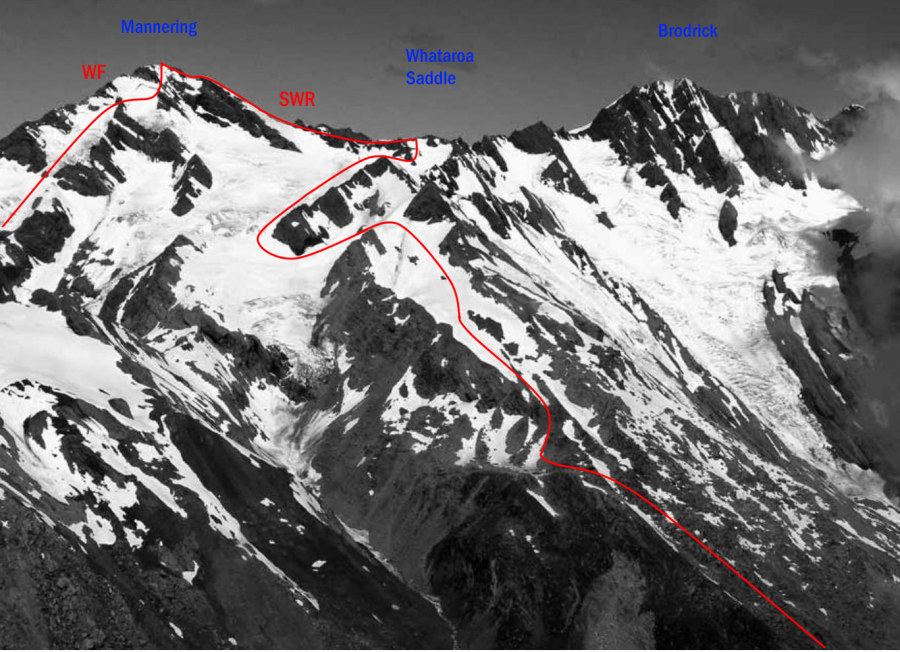
Image
Caption
Mts Mannering, Huss and Moffat from above Classen Saddle, December 2011
Rights credit
Bob McKerrow
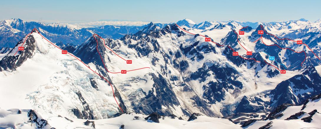
Routes
| Reference | Title | Grade | Length | Pro | Quality | Alert | Operations |
|---|---|---|---|---|---|---|---|
| 8.10 | 8.10South West Ridge, III,2+ | III,2+ | 0m | ||||
|
From Whataroa Saddle, ascend snow and rock on the Main Divide, passing an overhang near the summit by using a gut nearby. An alternative route from the saddle lies across slopes on the western side, approaching the summit from the south-west via a slabby rock rib.
|
|||||||
| WF | WFWest Face | 0m | |||||
From the Whataroa. Interesting rock slabs and snow patches. |
|||||||
| 8.11 | 8.11East Rib, II,3 | II,3 | 0m | ||||
|
Gained from the Classen Glacier. It’s also possible to access the upper rib via a shelf below Whataroa Saddle.
|
|||||||
Images
Comments
This place appears in
Attribution
ATP 2018 (Rob Frost)
Canterbury Westland Alps 2009 (Yvonne Cook and Geoff Spearpoint, CMC)
Canterbury Westland Alps 2009 (Yvonne Cook and Geoff Spearpoint, CMC)
UUID
a292bf72-523d-48b6-a35e-fce3e4af8ce6