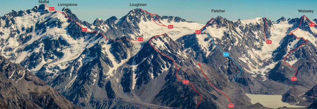
Mt Loughnan

Type
Altitude
2590m
Part of
Image
Caption

Mt Moffat and the peaks above the Maud and Grey Glaciers, December 2011 

Rights credit
Bob McKerrow
Lat/lon
-43.434193,170.475436, NZ Topo Map
Topo50
BX16 957 879
Add Place Add Route

Routes

Reference Title Grade Length Pro Quality Alert Operations
8.22 8.22North East Ridge, III,3 III,3 0m
0

At the base of the third buttress east of the summit are two detached rocks. From the Grey Glacier, climb up to the rocks then ascend to the Main Divide either via the rock rib or via snow slopes west of the detached rocks. Traverse along the serrated ridge, turning gendarmes on the Grey side. There are two or three peaks of similar height – the first one is the summit.


  • P1
  • Alpine (Commitment) III
  • Alpine (Technical) 3

 North West Flank, 2+ 2+ 0m
0

  • P1
  • Alpine (Mt Cook) 2+

From the Butler River head up the valley draining Grey Pass, initially sidling on the true right
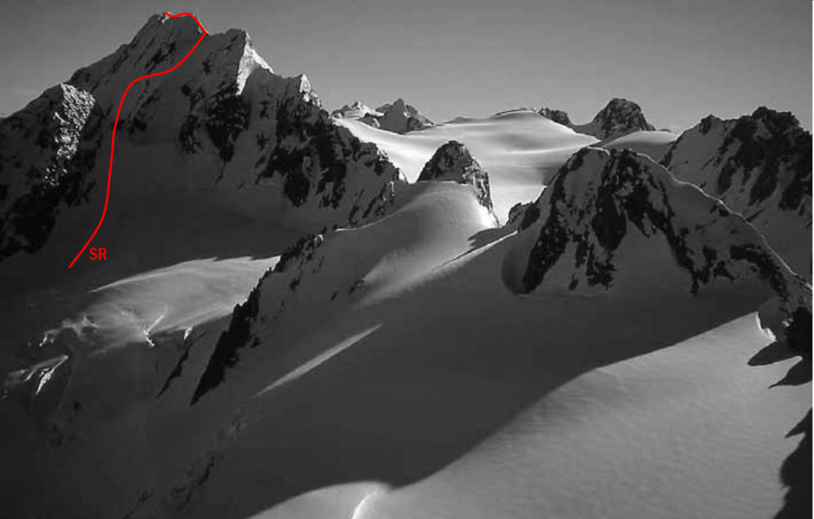
 to reach the basin above the 1100-metre contour. At about 1600 metres, head south-west over rock to a reach a snow shelf at about 1800 metres. Head south up a steeper band of slabby rock to the left of a small buttress and continue over a rib to the eastern edge of the permanent snow slope north of the peak at about 2100 metres. Continue up rock and snow bands left of the main snow gully, reaching the Main Divide at about 2480 metres. Snowslopes lead to the summit.


SR SRSouth Ridge, 2+ 2+ 0m
0

  • P1
  • Alpine (Mt Cook) 2+

Access the Nansen névé from the South Butler Valley. From the sharp col between Pt 2413 metres and Pt 2540 metres, steep firm rock on the first ascent (but steep snow slopes on a subsequent one), led to the Main Divide. Traverse over various small summits along the narrow and exposed South (Divide) Ridge. A step on the ridge is reportedly less difficult than it looks.


Images

Comments
Attribution
ATP 2018 (Rob Frost)
CW Alps 2009 (Geoff Spearpoint, Yvonne Cook, CMC)
UUID
 
c3e66004-7f44-46c3-ae6a-ee1a118e64b7