First reached from the east by W A Kennedy and Jack Lippe in February 1925.
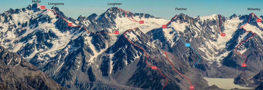
Peaks above the Grey and Maud Glaciers – Moffat to Wolseley, December 2011
From the head of the Grey Glacier: Climb easy snow slopes. The Grey icefall is usually negotiable at either edge until mid summer (grade II, 1+); after that consider going over Gordon Peak or even via the Maud Glacier up ‘Going Grey’ if your pack isn’t too heavy. Grey Pass should be crossed at its lowest point. Alternatively, climb Seymour to within 50m of the summit and then descend a short couloir on the western side.
To reach the Butler River from the pass, descend tending left, but cut back right through steep slabby sections when possible, to reach the easier basin below. Follow the stream down, sidling out onto the spur on the true right between 1100m and 1200m to avoid the confined lower section.
If beginning your descent near Seymour Peak, pick a line through bluffs to gain the main spur heading towards Ice Lake. Head north on the spur until about 1800m, then descend northwest to the Ice Lake outlet.
Routes
CW Alps 2009 (Geoff Spearpoint, Yvonne Cook, CMC)