Places
| Type | Name | Alert |
|---|---|---|
| Face | Philistine Bluffs |
Routes
| Reference | Title | Grade | Length | Pro | Quality | Alert | Operations |
|---|---|---|---|---|---|---|---|
| H | HWarnocks Bluff, 1 | 1 | 0m | ||||
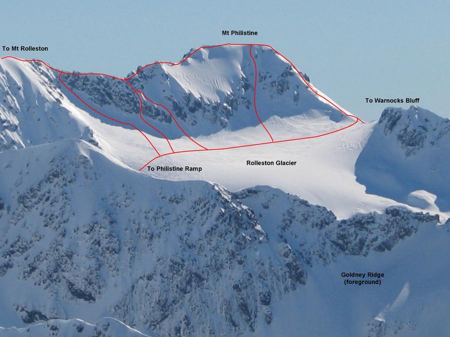
Climbed from the Otira Valley. Where the foot-bridge crosses the Otira River (about halfway up the valley) follow a vague track that crosses the vegetated moraine wall high on the true left. It then zigzags up the scree slide that leads to the base of the bluffs separating Warnocks Knob from Philistine’s East Ridge. Connecting ramps and gullies, find a path through the bluffs, giving access to the easier slopes above. In winter these bluffs are extremely dangerous when covered in loose snow or ice. An alternative route through the bluffs follows a stepped creek found further to the north, though this has similar winter problems. Above the bluffs continue following the ridge, staying true left of the east ridge buttress, then climbing snow slopes to join the saddle adjacent the Rolleston Glacier. The loose main ridge is easily climbed from here. |
|||||||
| From Rolleston River Track, 2 | 2 | 0m | |||||
Climbable via the giant gully that rises steeply for 1100 metres from the Rolleston River track (1.5km upstream of the railway bridge). This gut can be threatened by rock or ice fall in almost any season, and is invariably a very steep ice/loose scree climb for the final 200 metres to the col between Mt Philstine and its northwest summit (1780m). Warnocks Knob should be used as the preferred descent route. |
|||||||
| From Head of Rolleston River, 2 | 2 | 0m | |||||
From the head of the Rolleston River, climb via a steep, narrow couloir. This leaves the river via initial scree (K33 885121) and proceeds into a narrow rock gut for 200m before opening out to onto another scree slope. Keep the adjacent rock on the true left. Towards the top ascend diagonal rock gullies to join the west ridge on to the summit. Post winter route when avalanche risk is low. |
|||||||