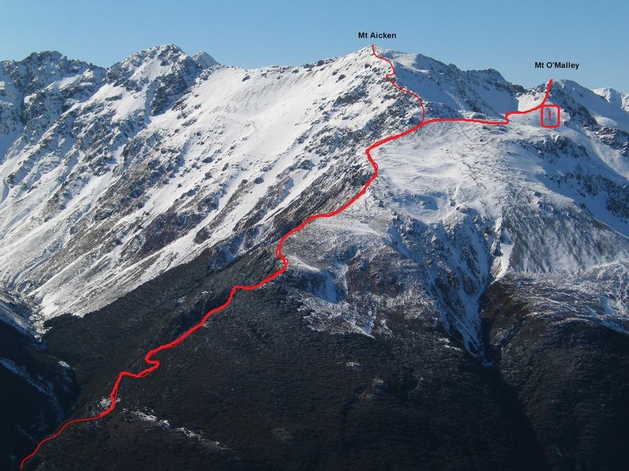
Type Mountain Altitude 1703m Part of Arthurs Pass Peaks Map Lat/lon-42.94681075,171.59472942, NZ Topo Map Topo50 BV20 854 441 Accessed from Bealey River Mingha River Image Routes Reference Title Grade Length Pro Quality Alert Operations 1 1Basin Route, 1 1 0m 0 Rate P1 Alpine (Technical) 1 From the basins to the south of the 1844m rise on the MT AICKEN ridge. A descent off the mountain is possible down Bretts Stream, but beware of huge loose rocks at its head. Add Place Add Route Log in to post comments Comments UUID 05c308d2-87bb-42f5-978d-fb82b8e937de