Type
Mountain
Altitude
1859m
Part of
Map
Accessed from
Image
Routes
| Reference | Title | Grade | Length | Pro | Quality | Alert | Operations |
|---|---|---|---|---|---|---|---|
| Normal Route, 1 | 1 | 0m | |||||
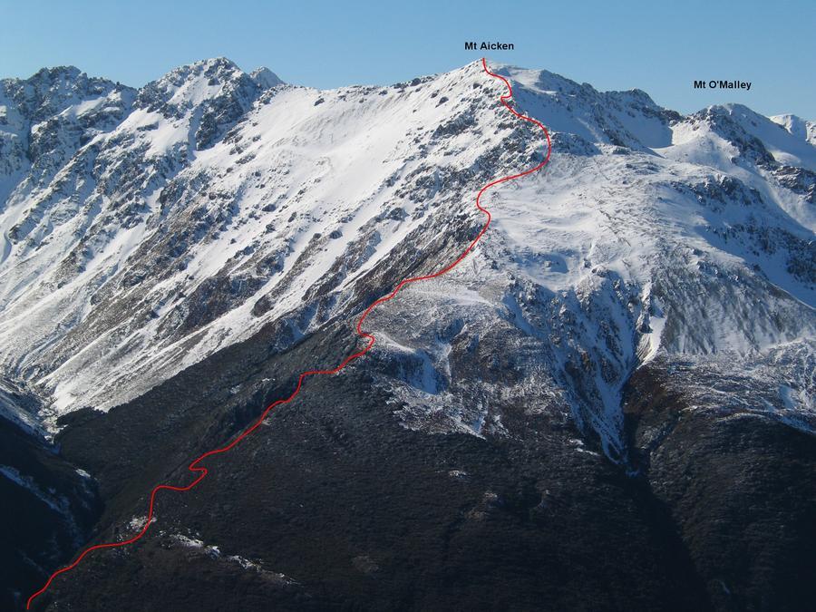
Easily reached via a steep walking track that commences at the bridge over Devils Punchbowl Creek. Be careful in winter of corniced snow towards the east. |
|||||||
| No Pant's Nathan, WI4 | WI4 | 60m | |||||
Located in the north branch of Graham Stream (Otira E2394300 N5806000). Accessible from above via scree into head of stream from the Mt Aicken track, or from below via Graham Stream. Waterfall ice normally begins to form here in late May / early June, though can be very short lived. |
|||||||
Comments
UUID
9cf327ff-778e-4654-9a7e-848f20ee5a50
I think Mnt Aicken is actually the bump much further left along the ridge in this photo (according to the topo). What is marked as Aicken here is actually unnamed point 1844m.