Mt Wakefield has been described as the focal point of Aoraki / Mount Cook National Park, and it certainly feels that way when you take in the view from the summit on a fine day.
A fast descent alternative to the south ridge in dry conditions is a scree slope from 1550m that drops directly to the valley floor. There are a number of glued moraine esque gullies that drop onto it, but the one at 1550m is the most mellow. There is also a large boulder at the top of the ~20m gully that a rope could be looped over to allow a rap onto the scree directly, but this should be executed with care to avoid rockfall, and certainly not during or after rain. See topo for entry point.
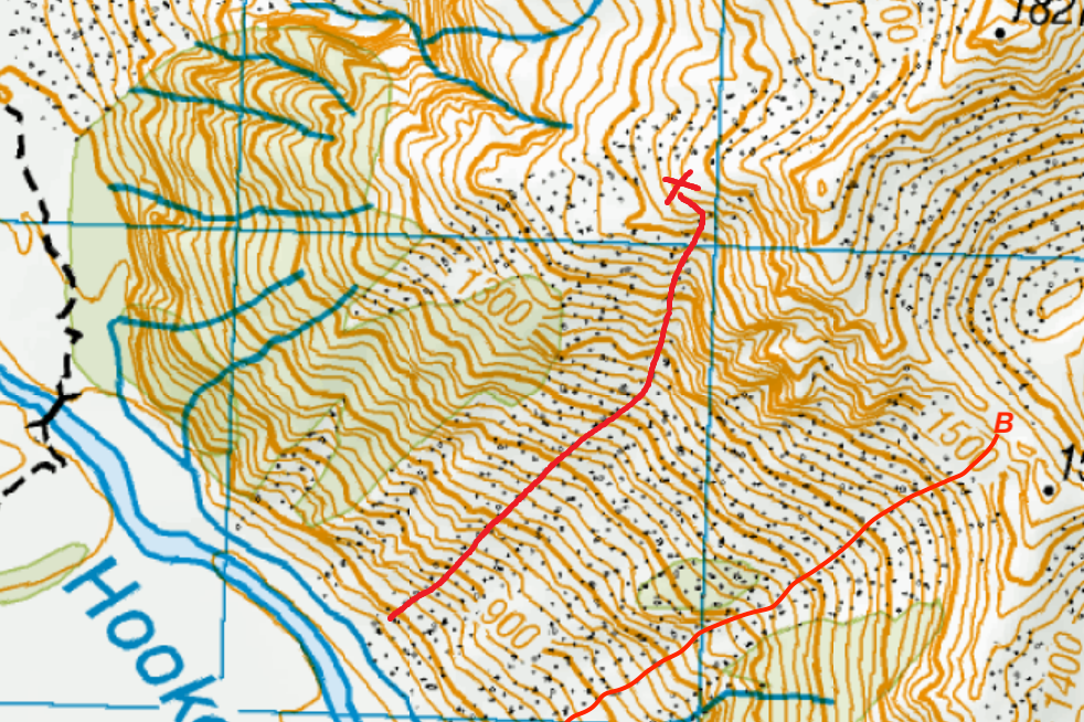
Map
Routes
| Reference | Title | Grade | Length | Pro | Quality | Alert | Operations |
|---|---|---|---|---|---|---|---|
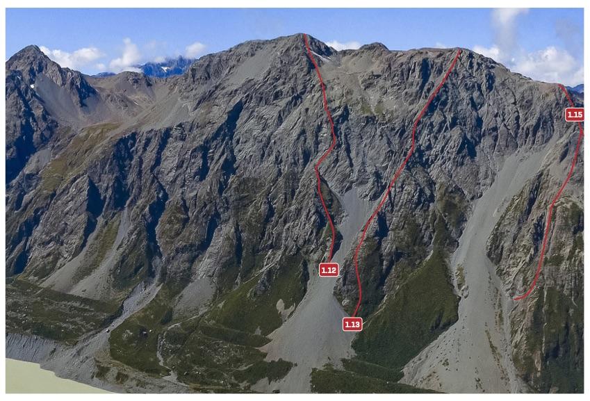
| 1.12 | 1.12Routeless Guide, III,3+,12 | III,3+,12 | 800m | ||||
|
The most direct line to Mt Wakefield’s summit. From the viewpoint at the end of the Hooker valley track, access the nearest scree fan descending from Mt Wakefield (the second large scree fan on the east side of the Hooker valley). Start on a compact sandstone staircase on the true right of the scree (grade 10–12), then follow a broken ridge to the cliff bands, which are the crux of the climb. Trend right from the flat col at the top of the ridge on superb weathered greywacke to behind the obvious pink notch on the right edge of the cliff bands. This bypasses the cliffs via another sandstone staircase (crux) to finish on easier ground and gullies to the summit.
|
|||||||
| 1.13 | 1.13Guideless Buttress, III,3,8 | III,3,8 | 800m | ||||
|
Also known as the Ranger Route, this 800m route was first climbed by local DOC staff in the summer of 2013 and offers some of the finest alpine scrambling near the village: enjoyable rock with some fantastic views and exposure. A fun and challenging day trip.
|
|||||||
| 1.14 | 1.14Wakefield Gullies, III,3 | III,3 | 800m | ||||
|
A number of gullies on both sides of the South West Ridge have been climbed when filled with snow and ice. Details about these routes are scarce – please add more information if you have it:
|
|||||||
| 1.15 | 1.15South West Ridge (Guides Route), II,2+ | II,2+ | 800m | ||||
|
This ridge was used as a training climb for guides in the early 1900s.There are several variations on the lower part of this ridge.
|
|||||||
| 1.16 | 1.16The Old Man and the Scree, I,4,15 | I,4,15 | 120m | ||||
|
This route is accessed from the first swingbridge on the Hooker valley track, along an old track that follows down the true left bank of the Hooker River. Visible from the village is a prominent scree slope and a series of buttresses leading to the ridge between Pt 1827m and Pt 1566m. Ascend the scree then aim for the left side of the buttress that separates a large hidden gully from the main scree. Climb slabs immediately right of a big corner and finish up the chimney. Two 60m pitches (grade 15), sparse protection, and loose rock. Walk off the back. According to Trev, it’s a ‘pretty worthless route for the effort to get there.’
|
|||||||
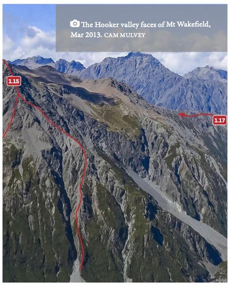
| 1.17 | 1.17South Ridge, I,1 | I,1 | 0m | ||||
|
This is an excellent day or overnight trip, with panoramic views. From the Tasman valley road bridge over the Hooker River, climb up the vegetated spur that eventually leads over scree and boulder fields to the summit. The true summit is a long way beyond the highest point that you can see from the village. Navigation on the upper ridge can be difficult in cloudy conditions. Descend the same way.
|
|||||||
Images