Type
Altitude
2645m
Part of
Lat/lon
-43.74156988,169.9963544, NZ Topo Map
Topo50
BY15 581 524
Accessed from
Places
| Type | Name | Alert |
|---|---|---|
| Face | South East Face |
Routes
| Reference | Title | Grade | Length | Pro | Quality | Alert | Operations |
|---|---|---|---|---|---|---|---|
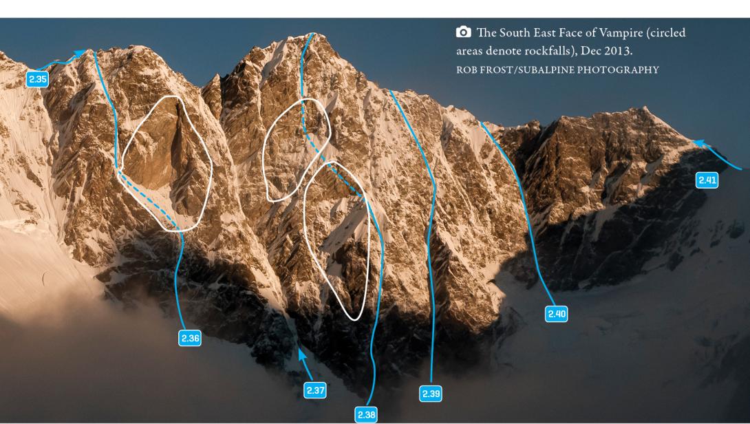
| 2.35 | 2.35South West Ridge, III,2+ | III,2+ | 0m | ||||
|
Gain the Main Divide at Bernard Col or one of the options further north (crux – technical grade 4). Then follow north along rotten rock on the Main Divide (much nicer with plenty of snow). It’s also possible to drop down to the west and climb the north west ridge. The technical grade is from Bernard Col.
|
|||||||
| 2.41 | 2.41North East Ridge, III,3 | III,3 | 0m | ||||
|
Via the Bannie Glacier and Christopher Col, then south over and around several rotten rock towers on the Main Divide.
|
|||||||
Comments
This place appears in
Attribution
ATP 2018 (Rob Frost)
UUID
3e976f59-3895-4fc2-b90e-cf132b7c78aa
