The first crossing, from the Cass to the Murchison, was by Tom Fyfe and Guy Mannering in December 1908.
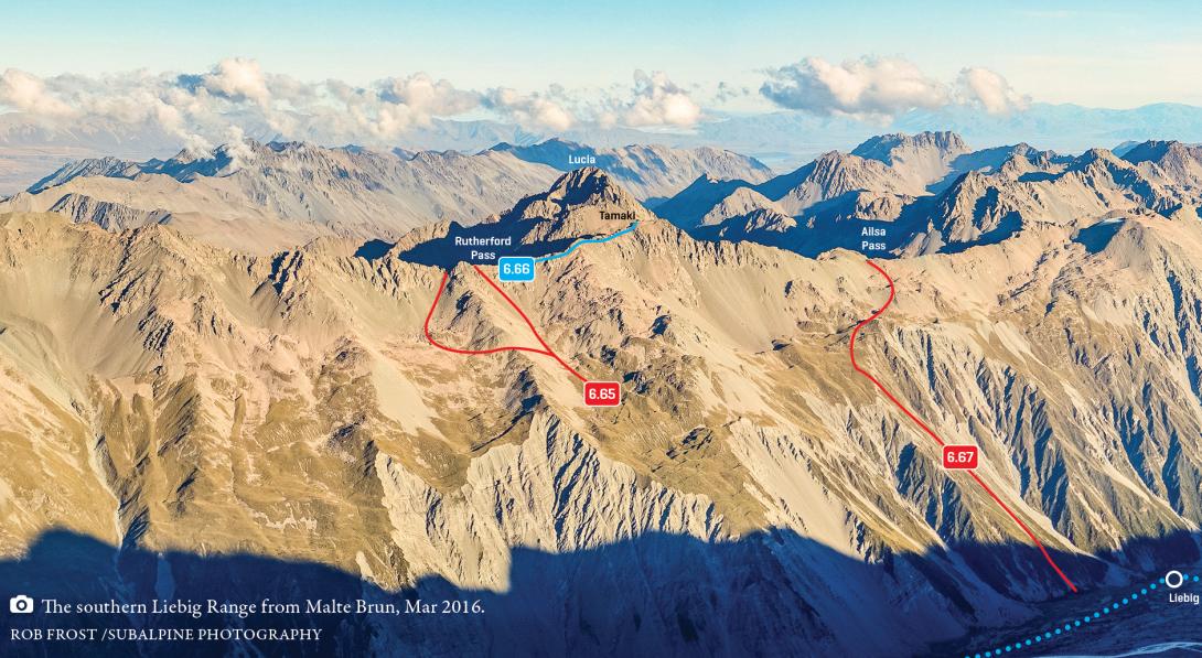
Southern Liebig Range, Rutherford Pass to Ailsa Pass, March 2016
Cass River: From the head of the Cass River, gain the base of the Ridge Glacier (or what remains of it) and then traverse to the rock notch of the pass.
Murchison valley: From near the downstream end of Murchison Lake, head up grass, scree, and snow slopes to a rock notch—this is the pass. Alternatively, it may be easier to gain the range crest at the next pass to the north, about 350m north of Rutherford Pass. The lower Murchison slopes of this part of the Liebig Range appear to be undergoing some pretty serious slumping, and the location of the best route out of the valley floor is likely to change considerably over the next few years (grade I, 2, route 6.65 on topo).