Mt Lucia is an alluring rock peak when viewed from the Cass.
Mt Lucia and Kehua Pass from the Ridge Glacier, May 2017
Routes
| Reference | Title | Grade | Length | Pro | Quality | Alert | Operations |
|---|---|---|---|---|---|---|---|
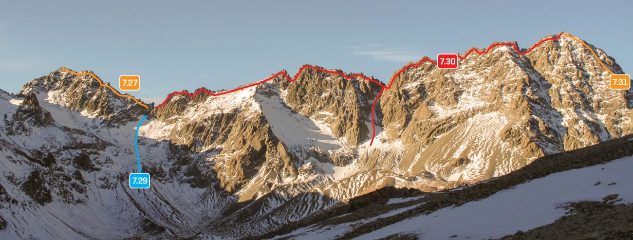
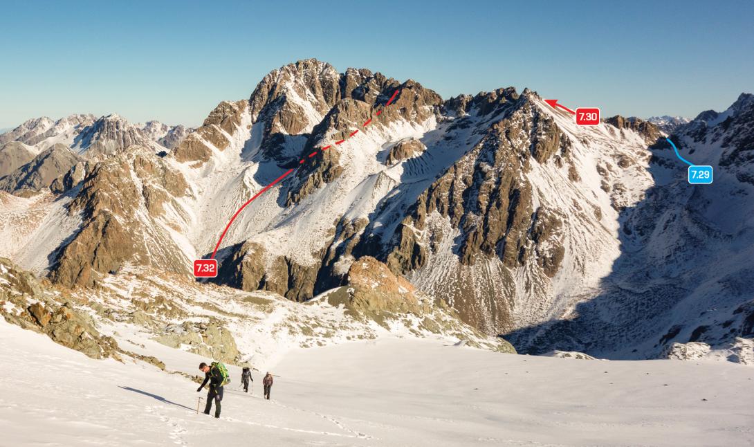
| 7.30 | 7.30North West Ridge, II,3 | II,3 | 0m | ||||
|
From Kehua Pass, a rock scramble along the ridge via Pt 2523m leads to the summit. It is also possible to climb up scree and snow slopes into a couloir that leads to about halfway along the ridge.
|
|||||||
| 7.31 | 7.31South East Ridge, II,2+ | II,2+ | 0m | ||||
|
Ascends from the confluence of the Ailsa and Cass valleys. A long, exposed rock scramble, which could have occasional snow arêtes depending on the season.
|
|||||||
| 7.32 | 7.32North Face, II,2+ | II,2+ | 0m | ||||
|
From the upper Cass, ascend scree slopes then a snow couloir to gain the ridge east of Pt 2523m. Essentially an access route to the upper north-west ridge.
|
|||||||
Images