Type
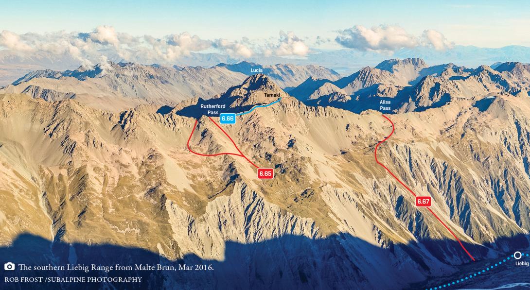
Pass
Altitude
2190m
Part of
Provides a good crossing between the Cass and Murchison catchments.
The high basin with a large tarn at the head of the Ailsa Stream is a wonderful spot in fine weather.
It may be easier to cross the Liebig Range 1.5km southwest of Ailsa Pass, just west of Pt 2405m.
Map
Approach
Murchison valley: Up valley of Liebig Hut, scramble up scree and snow slopes that lead to a slight depression, which is the pass.
Ailsa Stream: The east (Ailsa) side of the pass is shorter but steeper, and is easier when snow is present (grade I, 1+).
Accessed from
Image
Caption
Southern Liebig Range, Rutherford Pass to Ailsa Pass, March 2016
Rights credit
Rob Frost/Subalpine Photography
Comments
This place appears in
Attribution
ATP 2018 (Rob Frost)
UUID
82b96ae1-bf6c-40d3-8f7d-97c8c26c4723