Map
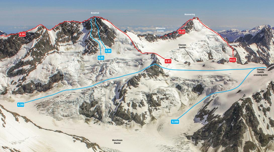
Mt Brodrick, the upper Murchison Glacier and Mt Mannering, December 2011
Routes
| Reference | Title | Grade | Length | Pro | Quality | Alert | Operations |
|---|---|---|---|---|---|---|---|
| 6.34 | 6.34West Ridge, III,3 | III,3 | 0m | ||||
|
From Whymper Saddle, follow the Main Divide, firstly on snow then rock to the Low Peak (about 2610m), and then continue to the summit.
|
|||||||
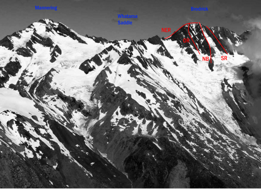
| 6.35 | 6.35South West Rib, III,3+ | III,3+ | 0m | ||||
|
Described as ‘the vague feature on the left side of the peak when seen from Murchison Hut.’ Leads to within 100m of the summit.
|
|||||||
| 6.36 | 6.36Loves Last , III,4 | III,4 | 0m | ||||
|
Climbs the central gully of the south-east face, finishing just right of the summit. When first climbed, the gully consisted of snow/ice low down and mixed climbing higher up.
|
|||||||
| 6.37 | 6.37East Ridge, II,2+ | II,2+ | 0m | ||||
|
Climb the ridge from Classen Saddle, which leads to snow slopes to arrive high on the Main Divide north of the summit, and then continue to the summit. An enjoyable route in spring. This or the North East Ridge usually offer the best descent from Brodrick.
|
|||||||
| North East Ridge, II,2+ | II,2+ | 0m | |||||
|
From Classen Saddle, traverse to the vicinity of Whataroa Saddle, then up snow or rock slopes east of the divide to reach the ridge southwest of Pt 2442, and then traverse the Main Divide to the summit.
|
|||||||
Places
| Type | Name | Alert |
|---|---|---|
| Face | West Face |
Images
Yvonne Cook and Geoff Spearpoint, in association with the Canterbury Mountaineering Club