Type
Mountain
Altitude
2444m
Part of
An excellent viewpoint. From the 1910s to 1950s this peak was often incorrectly referred to as Mt Lucia.
Map
Accessed from
Image
Caption
Mt Tāmaki, Kehua Pass and Mt Lucia from the south-west, June 2015
Rights credit
Richard Davies
Image
Caption
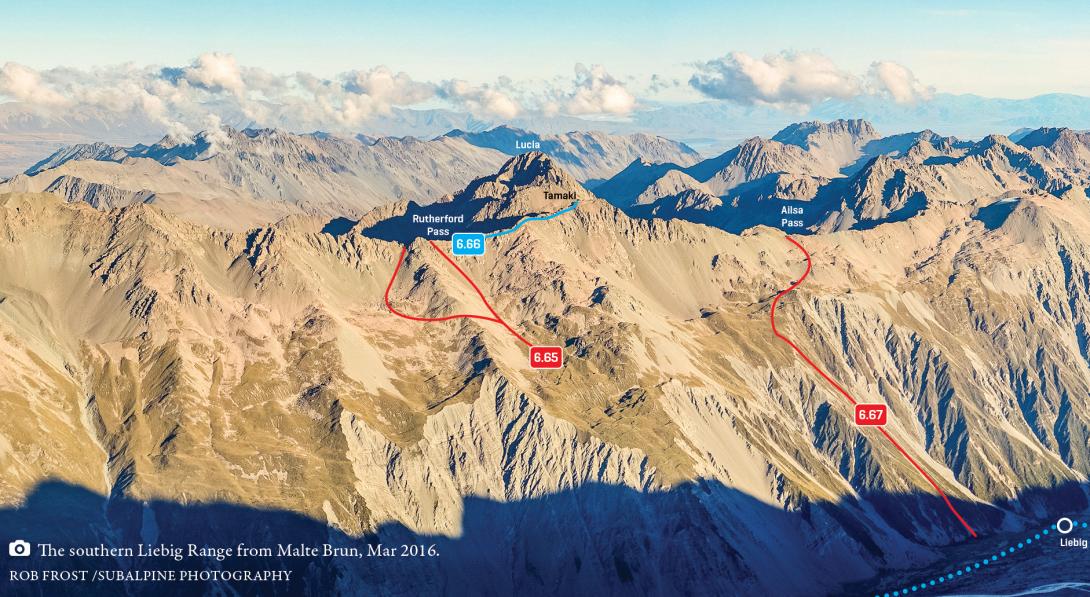
Southern Liebig Range, Rutherford Pass to Ailsa Pass, March 2016
Rights credit
Rob Frost/Subalpine Photography
Routes
| Reference | Title | Grade | Length | Pro | Quality | Alert | Operations |
|---|---|---|---|---|---|---|---|
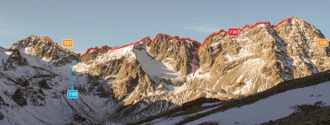
| 7.27 | 7.27South East Ridge, I,1+ | I,1+ | 0m | ||||
|
A straightforward rock scramble from Kehua Pass.
|
|||||||
| North East Ridge, I,1+ | I,1+ | 0m | |||||
|
From Rutherford Pass, traverse the crest of the Liebig Range over Pt 2382m.
|
|||||||
| 6.66 | 6.66From the Murchison, I,1+ | I,1+ | 0m | ||||
|
A straightforward rock scramble from Rutherford Pass or more directly from the floor of the Murchison valley.
|
|||||||
| South West Ridge, I,2 | I,2 | 0m | |||||
|
Ascend snow slopes to the Liebig Range south-west of the summit, then scramble to the top.
|
|||||||
Comments
This place appears in
Attribution
ATP 2018 (Rob Frost)
UUID
7fc7580c-db6c-4cef-b62f-110b10bd8812