Named by Melville Glasgow because of the saddle's proximity to The Anthill. Armadillos have a fondness for ants. B Patterson of Oamaru made the first crossing (NZAJ 1967, p.127). First accessed from the Godley by W Patterson in 1946 and first crossed by the J W Taylor rescue party in January 1953.
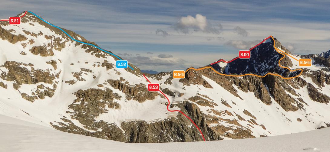
The Ant-hill, Armadillo Saddle and Conrad from the top of the Harper Glacier, December 2016
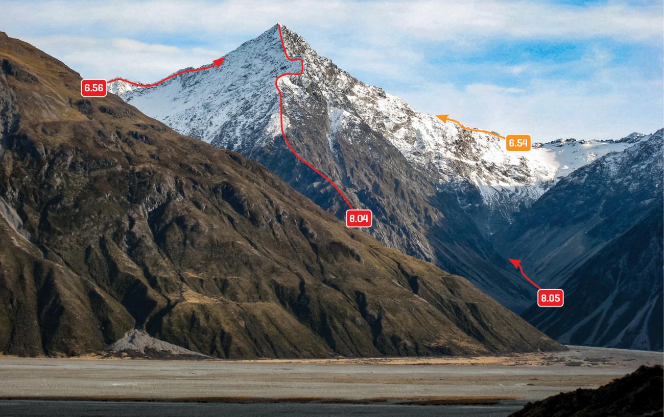
While this is probably the least technical crossing between the Murchison and Godley valleys, careful route-finding on the Murchison side is needed. Note that the best crossing point is the 2170m saddle west of The Ant-hill, not Armadillo Saddle itself (grade II, 1+).
From the Murchison Glacier: Route 6.53 on topo. Head up the stream draining the Harper Glacier on the true left. The head of this stream is surrounded by bluffs, but there is a sloping, bouldery shelf running through them that begins at 1800m, grid ref BX16 915 763.
This leads up to 2000m at about grid ref BX16 918 762, from where the final climb to the 2170m saddle, at the base of the West Ridge of The Ant-hill, is straightforward.
At least one party has traversed to the saddle from the moraine wall beneath the West Face of Conrad, and found it to be ‘mostly straightforward.’
To descend to Rutherford Stream, sidle to the right on moderately steep snow beneath Pt 2220m, and then descend snow and scree to the stream. There are some waterfalls in Rutherford Stream at 1270m that can be avoided with a high sidle on the true left.
From the Godley valley: Head up the north branch of Rutherford Stream, sidling high on the true left to avoid waterfalls at 1270m (route 8.05 on photo topo). Choose a route up scree and snow to the 2170m pass – most parties opt for a sidle beneath Pt 2220m.
When descending to the Murchison, a common mistake is to head too far north towards the Harper Glacier, which ends in steep cliffs. Instead, head slightly west of north, down easy ground, until about 2000m, then turn hard left and traverse to find the top of a sloping bouldery shelf at BX16 918 762. Follow the shelf down to the true left of the valley floor at about BX16 915 763. Follow the true left of Harper Stream down to the Murchison. Alternatively, it is possible to traverse the western slopes of the Liebig Range until beneath the west face of Conrad, then drop down to the Murchison.
Routes
Images