Type
Pass
Altitude
2377m
Part of
An infrequently used crossing.
Map
Approach
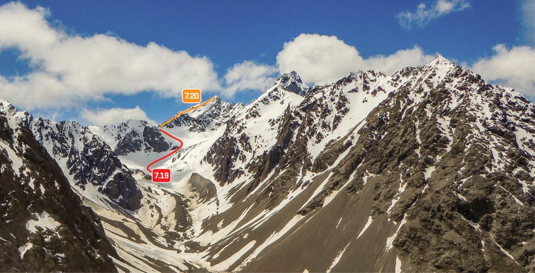
From upper Pinnacle Stream: ascend the true left of the Monk Glacier to reach the pass (route 7.19).
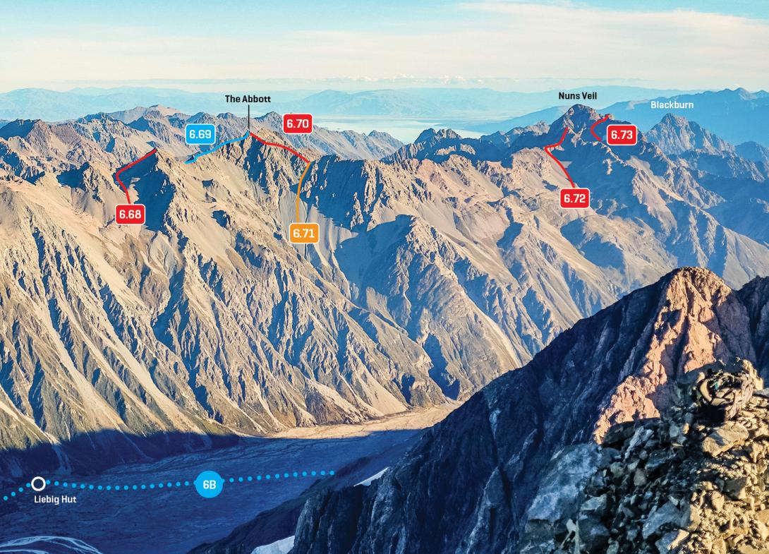
From Murchison valley: A direct route from the Murchison is complicated by deeply incised gullies, bluffs, and scrub. It is probably easier to begin about 2km further downstream, and climb over a 2000m saddle into the basin below the pass. The final climb to the pass is on scree and snow gullies (grade I, 1+, route 6.71).
Accessed from
Image
Caption
Abbey Pass and The Abbott at the head of Pinnacle Stream, November 2016
Rights credit
Penny Brothers
Image
Caption
Southern Liebig Range, Jollie Pk to Mt Biretta, March 2016
Rights credit
Rob Frost/Subalpine Photography
Comments
This place appears in
Attribution
ATP 2018 (Rob Frost)
UUID
7b863e2a-c2f0-406c-889c-4da5a4ee7dad